By using rail maps of modern cities, people could play for their own modern day home town.
Instead of countries play for stations, and instead of continents play for lines.
This could be applied to cities all over the world.
Places like Merseyside (Where i live) that don't have a rail network as complex as others like London could have other public transport systems incorporated like main bus routes and Mersey Ferry river crossings.
I've never designed a map before so if this is rubbish i wont be surprised. However if anyone likes this idea i would appreciate any feed back to get it developed.
This might be stupid but what about rail way maps? No really
Moderator: Cartographers
Forum rules
Please read the Community Guidelines before posting.
Please read the Community Guidelines before posting.
-
Malcom2820
- Posts: 2
- Joined: Fri Jul 06, 2012 6:27 am
-
koontz1973
- Posts: 6960
- Joined: Thu Jan 01, 2009 10:57 am
Re: This might be stupid but what about rail way maps? No re
Rail maps of cities is an idea that is right now being worked on for the Paris map in the drafting room. And no it is not a silly idea. It is just another way of doing something that has already been done. Just remember to not use copyrighted symbols.


Re: This might be stupid but what about rail way maps? No re
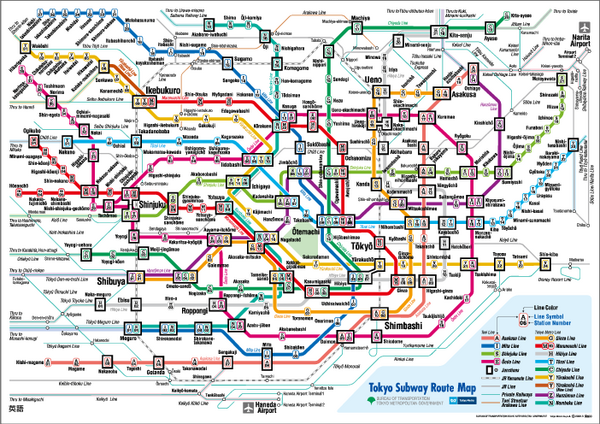
tokyo metro might be nice.
- Click image to enlarge.
- Click image to enlarge.


-
Industrial Helix

- Posts: 3462
- Joined: Mon Jul 14, 2008 6:49 pm
- Gender: Female
- Location: Ohio
Re: This might be stupid but what about rail way maps? No re
Tokyo Metro... and I thought trying to figure you out ended when I moved back to the USA
Sketchblog [Update 07/25/11]: http://indyhelixsketch.blogspot.com/
Living in Japan [Update 07/17/11]: http://mirrorcountryih.blogspot.com/
Russian Revolution map for ConquerClub [07/20/11]: http://www.conquerclub.com/forum/viewto ... 1&t=116575
Living in Japan [Update 07/17/11]: http://mirrorcountryih.blogspot.com/
Russian Revolution map for ConquerClub [07/20/11]: http://www.conquerclub.com/forum/viewto ... 1&t=116575