thegurumonkey wrote:Hi,
We've all had it where our strategy hinges on a dubious assumption about whether certain territories are connected.
It would be GREAT to have a (very basic) schematic map that you could toggle on to answer any such questions. It need not be beautiful, just functional.
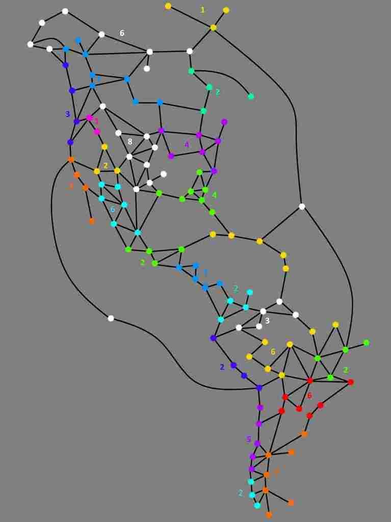
For example, the below is a schematic of the 'First Nations of the Americas' map
Photobucket no longer supports hotlinking. You'll have to rehost that at imageshack or imgur.
In any case, if you're using panel mode, you have a text map available that shows exactly what you're asking for, a list of all the links.
Go to the Settings tab, and change your Text Map to Extended.

Once you do that, in your map tab you will have a detailed list of what territory links to what, like this:

Text map has three levels: Off, Standard (which shows limited information) and Extended (which shows a lot more information.) You can also set settings differently for different maps, so that (for instance) you use Standard on most maps but Extended on the trickier maps.