Conquer Club

Napoleonic Europe 1812 - Ver 41/44 [Quenched]

Care to peruse completed maps? Take a stroll through the Atlas.

Moderator: Cartographers

Forum rules
Please read the Community Guidelines before posting.

Napoleonic Europe 1812 - Ver 41/44 [Quenched]

Postby Kabanellas on Fri Oct 09, 2009 5:38 pm

ImageImageImage

ImageImageImageImageImage

Idea/Concept - Raskholnikov
Design/Concept - Kabanellas
Code - ender516

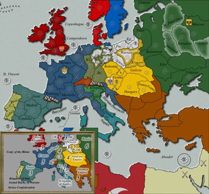
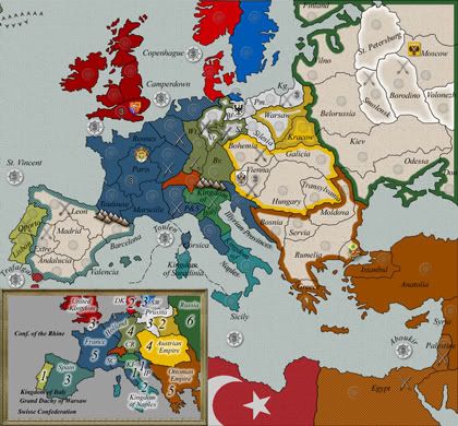
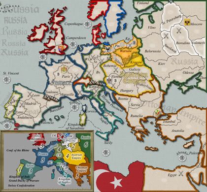
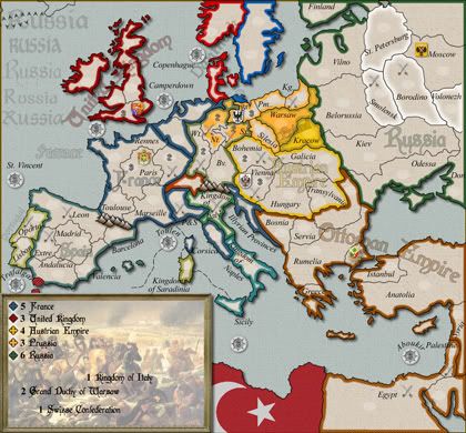
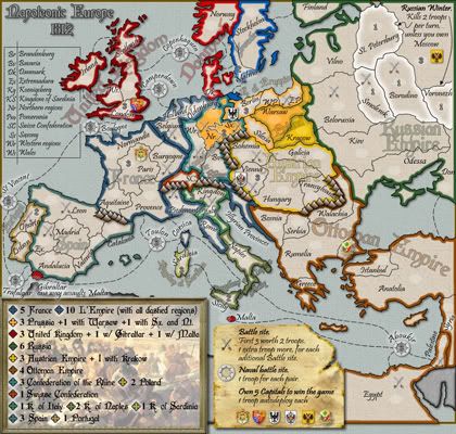
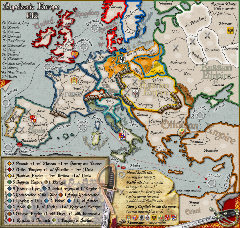
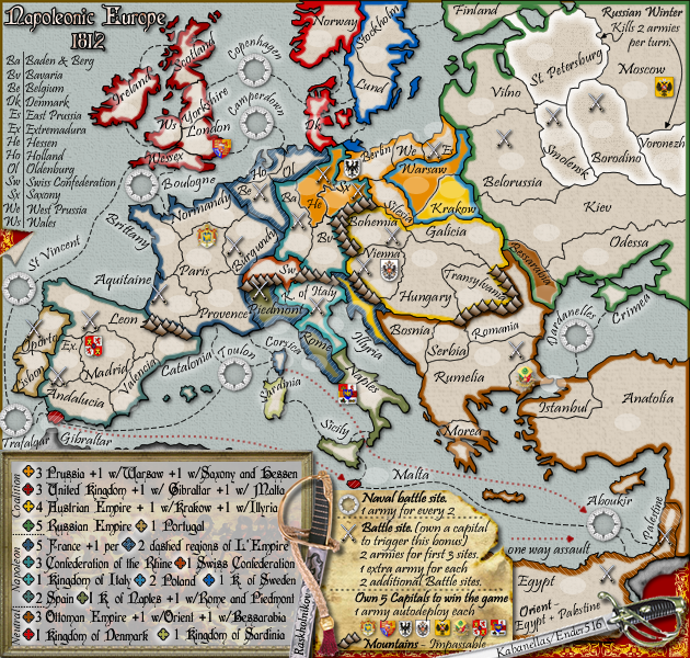
After a lot of inside debate, here it is, the map we’ve been promising (this is version #21 btw, I'm posting previous tests and versions below).
The idea was to recreate Europe by the time of Napoleon, in 1812 precisely. Europe by that time offers a multitude of political and social idiosyncrasies holding all the right ingredients for a map that could be both interesting in terms of game-play and at the same time respect carefully all historical facts.

Graphically, the map is designed on a ‘handmade look’ concept. A map that could be handled by Napoleon himself. ;)

European Powers

French Empire: 12
France: 6
Empire: 6

British Empire: 8
United Kingdom: 6
British Fortresses: 2

Russian Empire: 12
Ottoman Empire: 10
Austrian Empire: 5
Kingdom of Prussia: 4
-------------------------------------------
Confederation of the Rhine: 4
Denmark: 2
Sweden: 2
Swiss Confederation: 1
Poland: 2
Kingdom of Italy: 1
Kingdom of Sardinia: 1
Kingdom of Naples and Sicily: 2
Kingdom of Portugal: 2
Kingdom of Spain: 6

Naval Battles: 8
Land Battles: 20

Regions (total) - 82
Starting neutral - 29
To be distributed by players - 53

XML- http://www.fileden.com/files/2009/11/9/2644838/NapoleonicEurope.V1.13.xml
Large map- http://i998.photobucket.com/albums/af105/Kabanellas/NapoleonicEurope_V41a_Image_OF.png
Small map- http://i998.photobucket.com/albums/af105/Kabanellas/NapoleonicEurope_V44_Image_small_OF.png

Large map version 41
Click image to enlarge.
image


Small map version 44
Click image to enlarge.
image


Last versions
Version 21- http://i998.photobucket.com/albums/af105/Kabanellas/NapoleonicEurope_V21.jpg
Version 22- http://i998.photobucket.com/albums/af105/Kabanellas/NapoleonicEurope_V22a.jpg
Version 25- http://i998.photobucket.com/albums/af105/Kabanellas/NapoleonicEurope_V25Image.png
Version 26- http://i998.photobucket.com/albums/af105/Kabanellas/NapoleonicEurope_V26image.png
Version 27- http://i998.photobucket.com/albums/af105/Kabanellas/NapoleonicEurope_1-3ab_img.png
Version 28 - http://i998.photobucket.com/albums/af105/Kabanellas/NapoleonicEurope_V28Image.png
Version 29 - http://i998.photobucket.com/albums/af105/Kabanellas/NapoleonicEurope_V29Image_img.png
Version 32 - http://i998.photobucket.com/albums/af105/Kabanellas/NapoleonicEurope_V30_img.png
Version 33 - http://i998.photobucket.com/albums/af105/Kabanellas/NapoleonicEurope_V32_Image.png
Version 34 - http://i998.photobucket.com/albums/af105/Kabanellas/NapoleonicEurope_V33_Image.png
Version 36 - http://i998.photobucket.com/albums/af105/Kabanellas/NapoleonicEurope_V36_Image-1.png
Version 39 - http://i998.photobucket.com/albums/af105/Kabanellas/NapoleonicEurope_V38b_Image.png


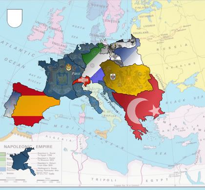
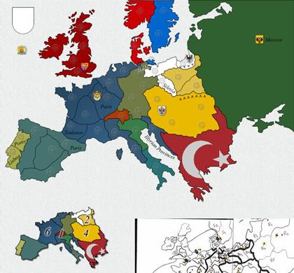
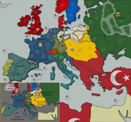
You can check out some of the earlier versions and tests for this design below:

show: old Versions
Last edited by Kabanellas on Wed Dec 01, 2010 4:06 pm, edited 55 times in total.
Major Kabanellas
 
Posts: 1482
Joined: Fri Feb 27, 2009 12:21 pm
Location: Porto, Portugal

Re: Napoleonic Europe 1812 (an original idea from Raskholnikov)

Postby Beko the Great on Sat Oct 10, 2009 9:17 am

Hi there Kabanellas! First, rename Oporto to Porto. If the language of the map is English, then, by the newest english convention, it must be named Porto (the name in Portuguese as you know). Then, about Portugal as well, Porto area is including Lisbon which is just funny :).

More, I'm not sure if the actual XML supports the idea of Russian Winter, that is, killing 2 armies per turn is allowed, but the other condition I'm not sure if it works, that is, if owning Moscow that thing doesn't happen...

Beside these two small concerns, I think gameplay is fine and the graphics are awesome!

Good luck with this one!
User avatar
Major Beko the Great
 
Posts: 802
Joined: Fri Oct 26, 2007 3:27 am
Location: Best Score: 3555 pts - 22-11-2014

Re: Napoleonic Europe 1812 (an original idea from Raskholnikov)

Postby Kabanellas on Sat Oct 10, 2009 10:34 am

Thanks a lot Beko.

Didn’t know that :). I’ve been reading Oporto everywhere outside Portugal for so long that I might have missed something. We’ll change it.

The border line was drawn through river Tejo… I’ll move it up a bit to cover Lisbon as well.
Major Kabanellas
 
Posts: 1482
Joined: Fri Feb 27, 2009 12:21 pm
Location: Porto, Portugal

Re: Napoleonic Europe 1812 (an original idea from Raskholnikov)

Postby Industrial Helix on Sat Oct 10, 2009 10:48 am

Ah this looks great. I'm so excited to play it!

I'd say either lose or move the swords, Egypt gets lost in them.

And Essex would not be the correct name for that part of England, I believe. Perhaps Sussex, Somerset, or Devon, maybe even Cornwall, would work for it.

I definitely have more crits and will keep them coming, running low on time and I didn't want to forget them while I thought of 'em. Nice work so far!
Sketchblog [Update 07/25/11]: http://indyhelixsketch.blogspot.com/
Living in Japan [Update 07/17/11]: http://mirrorcountryih.blogspot.com/
Russian Revolution map for ConquerClub [07/20/11]: viewtopic.php?f=241&t=116575
User avatar
Cook Industrial Helix
 
Posts: 3462
Joined: Mon Jul 14, 2008 6:49 pm
Location: Ohio

Re: Napoleonic Europe 1812 (an original idea from Raskholnikov)

Postby Raskholnikov on Sat Oct 10, 2009 11:10 am

Thanks for the comments, Helix. We'll change the UK region to Sussex, as you proposed.

As to the swords, I think they don't take anything away from Egypt and Palestine - in fact, they are both decorative and a good transition from the legends to the map and a way to establish a western border to the Ottoman Empire, which as we know continued to west to Lybia and south to Sudan (although of course the actual control of Istanbul over North Africa varied with times and was tenuous at best).

I look forward to hear your other comments! Thanks again for your input!
User avatar
Private Raskholnikov
 
Posts: 638
Joined: Fri Sep 11, 2009 3:40 pm

Re: Napoleonic Europe 1812 (an original idea from Raskholnikov)

Postby Kabanellas on Sat Oct 10, 2009 11:55 am

Thanks a lot Helix.

Well those swords… how I love those swords left there by Napoleon’s officers, thrown over the board map with no care. :)
Major Kabanellas
 
Posts: 1482
Joined: Fri Feb 27, 2009 12:21 pm
Location: Porto, Portugal

Re: Napoleonic Europe 1812 (an original idea from Raskholnikov)

Postby thenobodies80 on Sat Oct 10, 2009 1:16 pm

Beko the Great wrote:More, I'm not sure if the actual XML supports the idea of Russian Winter, that is, killing 2 armies per turn is allowed, but the other condition I'm not sure if it works, that is, if owning Moscow that thing doesn't happen...


yes it can't be done. They will lose 2 troops even if you control Moscow.
User avatar
Sergeant 1st Class thenobodies80
 
Posts: 5400
Joined: Wed Sep 05, 2007 4:30 am
Location: Milan

Re: Napoleonic Europe 1812 (an original idea from Raskholnikov)

Postby Raskholnikov on Sat Oct 10, 2009 3:20 pm

Thanks for claryfing this. I think it's a worthwhile feature to have even in this case, especially since none of the four territories concerned are border provinces which need to be defended in strength once one controls the Russian Empire. In addition, they will all start as 1-army neutrals, so this won't affect the drop either.
User avatar
Private Raskholnikov
 
Posts: 638
Joined: Fri Sep 11, 2009 3:40 pm

Re: Napoleonic Europe 1812 (an original idea from Raskholnikov)

Postby Kabanellas on Sat Oct 10, 2009 4:26 pm

seems reasonable to me
Major Kabanellas
 
Posts: 1482
Joined: Fri Feb 27, 2009 12:21 pm
Location: Porto, Portugal

Re: Napoleonic Europe 1812 (an original idea from Raskholnikov)

Postby AndrewB on Sat Oct 10, 2009 5:25 pm

Here is some of the things I have mentioned:

1. I dont think mountains goes well with this map.
2. Can we have a one way arrow from Corse to Gibraltar? Cause is was looking for an explanation for a star for awhile.
3. Should not it be called Corsica, not Corse?
4. Is the a country in Balearic islands? Same question to crete and cyprus.
5. It is difficult to understand the bonus structure in the central europe. Some areas have 2 colors around them...
Image
User avatar
Lieutenant AndrewB
 
Posts: 1814
Joined: Mon Jun 12, 2006 5:02 pm
Location: Edmonton, Canada, MST

Re: Napoleonic Europe 1812 (an original idea from Raskholnikov)

Postby Raskholnikov on Sat Oct 10, 2009 5:42 pm

1. I dont think mountains goes well with this map.

Why? we used them sparingly and only where they are impassable and contribute to the balance of the game.

2. Can we have a one way arrow from Corse to Gibraltar? Cause is was looking for an explanation for a star for awhile.

Yes. We can do the same with Gibraltar.

3. Should not it be called Corsica, not Corse?

All French territories use the name of that territory in French. Corsica is Corse in French.

4. Is the a country in Balearic islands? Same question to crete and cyprus.

No for all. Balearics are part of Valencia, Crete of Greece, Cyprus of Anatolia.

5. It is difficult to understand the bonus structure in the central europe. Some areas have 2 colors around them...

Yes. This represents the dynamics of border changes under Napoleon. The inner color is the color of the empire who lost these territories because of Napoleon's intervention. The border color represents the political unit to which they belong now. Should they be reconquered by their original owner, the original owner gets a bonus.

Example: Prussia lost Warsaw to Poland, Hessen and Saxony to The Rhine Confederation ( both political entities created by Napoleon, which now have their own bunus). Should Prussia reconquer either Warsaw, or Hessen and Saxony together, it will get an additional army for each.

The same applies to Austria regarding Krakow and the Illyrian provinces, as well as to the Ottoman Empire and Bessarabia (ceded to Russia in 1812, a few days before Napoleon's Russian campaign began).

I hope this clarifies matters. I think the legend is very clear on this last point.

Thank you for your comments.
User avatar
Private Raskholnikov
 
Posts: 638
Joined: Fri Sep 11, 2009 3:40 pm

Re: Napoleonic Europe 1812 (an original idea from Raskholnikov)

Postby Raskholnikov on Sat Oct 10, 2009 8:48 pm

I must regretfully announce that the.killling.44 is no longer part of the Napoleonic Europe 1812 project. He kindly offered to help when I first proposed this project and post the original outline map. He agreed that the work would be shared between the two of us and Kabanellas, our third team member. Kabanellas is an architecht in real life and I hoped he would concentrate on the graphic aspect of the task, while the.killing.44 would focus on coding the map in XML, which is his expertise.

I started doing the graphic work with Kabanellas, as shown by the various drafts posted. Kabanellas asked me to provide him with borders to use, and since I do not have adequate equipment, I provided the.killing.44, in good faith, with all the maps and links required to develop the map and spent a few hours with him dictating to him exactly what borders to draw, and what names to use. He then said he was interested to contribute to the artistic design too. I replied that he was welcome to, that he could present his ideas and we would all discuss them and pick out what would work best for the project.

For the next two weeks, the.killing.44 more or less dissappeared because of his school commitments. During this time, Kabanellas and I worked together on a virtually daily basis in two- to three hour sessions and went through 21 iterations to develop the map draft presented in the thread above. When the.killing.44 finally got back in touch again, he rejected virtually the entire work done by the two of us and said he wanted to take an entirely different "artistic direction". At this time, all he had in his possession was the basic map he had developed under my direction from maps I had provided him with.

Since we were supposed to work as a team, and given the fact that I knew he is a kid in ninth grade and wanted to be nice to him, I asked him to develop his ideas and bring them for discussion between the three of us, and we would then decide together what worked best.

After almost another week without hearing from him I contacted the.killing.44, who to my surprise and disappointment informed me that he intended to use "his" map to develop a competing project to the one he had originally joined. When I told him that he could not do this because the entire basis of Napoleonic Europe 1812, including all maps in his possession and all borders he had traced and names he has used and bonus structure we had developed has originated with Kabanellas and I, he stated, to my amazement, that:

"you gave me image links that if we disband i research and find on my own. i trace the borders from research that i have "refound" on my own, and it is still in my sole usage. from there, i go back and use publicly posted guides to determine what i want for "refound" bonuses, etc. as long as my map is "inherently different in gameplay or graphics" — as said in the foundry — it's mine and you cannot
disprove it."

I find such an attitude absolutely reprehensible. Even taking into consideration that we are dealing here with a 15 year old kid, such blatant bad faith and inability to work together as a team in a group cannot be simply ignored. Developing maps should be a fun, collaborative process, not an occasion to waste my time pacyfing the overblown ego of a child who is throwing a tantrum because work on this project has progressed while he was AWOL and wants now to start over from scratch - simply because he doesn't like the "artistic direction" taken by Kabanellas and wants to replace it with his own. Failing which, he proposes to set up a competing map based on the very same ideas, resources and direction I provided to him in good faith and claim he "refound" it all on his own. This is more than than the wounded pride of a little boy - it is outright dishonesty.

Therefore, as of now, the.killing.44 is no longer involved in the Napoleonic Europe 1812 project and any project on the same theme he might submit which is based on materials and directions he had access to in good faith while working with us should not be taken into consideration, as not being "INHERENTLY different in gameplay or graphics".
User avatar
Private Raskholnikov
 
Posts: 638
Joined: Fri Sep 11, 2009 3:40 pm

Re: Napoleonic Europe 1812 (an original idea from Raskholnikov)

Postby the.killing.44 on Sat Oct 10, 2009 8:57 pm

Hahaha. Basically, I said I wanted to figure out which graphical direction people liked better, and so we'd post two images. Then you said you thought I was going to leave the group, etc. etc. I never actually said that, but only wanted to get the idea out of your head I could actually make a map. You basically got riled up over a little thing and I played along to my amusement.

Whatever. I don't see why you needed to write a novel for public view. Good luck with the map, Kab.
User avatar
Captain the.killing.44
 
Posts: 4724
Joined: Thu Oct 23, 2008 7:43 pm
Location: now tell me what got two gums and knows how to spit rhymes

Re: Napoleonic Europe 1812 (an original idea from Raskholnikov)

Postby Raskholnikov on Sat Oct 10, 2009 9:15 pm

Actually, this is how the chat developed:

"raskholnikov says: k. when do you think you will have a fully finished draft?
the.вбивствo.44 says:
soonish
i'll make a thread when i do
raskholnikov says:
a different thread? why? it's the same project we're supposed to work together, so let's keep it all togeher. post it in our thread and we'll take it from there.
the.вбивствo.44 says:
with two images?
raskholnikov says:
sure. we will eventually have to agree to one no?
the.вбивствo.44 says:
perhaps; in any case the same thread with two images isn't going to work
raskholnikov says:
well this will be very confusing it will look like we have two competing projects which is not the case; and i dont want that
the.вбивствo.44 says:
could be better for deciding an image
i'm all up for doing that
raskholnikov says:
doing what? having two competing projects?
the.вбивствo.44 says:
until we see which is the better accepted image
raskholnikov says:
no i dont agree. your map is the map i developed and i wont have it used by two different people who cant agree on graphics. i will not allow that. we're supposed to work together as a team, on one project.
the.вбивствo.44 says:
conflicting members ≠ a team"

Clearly, I did my best to keep this all within our team and integrate your ideas and suggestions into our work. You refused, decided you wanted to set up a separate thread, confirmed you wanted to develop a competing project "until we see which is the better accepted image" and implicitly stated you did not consider yourself part of the team working on this project because "conflicting members ≠ a team". Members of a team working on a project debate their ideas and learn to compromise in order to create the best possible project. They don't throw tantrums, threaten to set up alternative projects and to appropriate others' work as "refound" because I could not "disprove it". This is not a "small thing" about which I "got riled". It is sheer bad faith and dishonesty.
User avatar
Private Raskholnikov
 
Posts: 638
Joined: Fri Sep 11, 2009 3:40 pm

Re: Napoleonic Europe 1812 (an original idea from Raskholnikov)

Postby the.killing.44 on Sat Oct 10, 2009 9:22 pm

raskol says:
i  can prove how i developed this map from the start and how you did all the borders on my instruction. i will not allow you to use my map as a competing map if you don;t work with us as a team.

At which point he started to threaten me that using ideas and public images was illegal. The point is you blew it up way too big when I wanted to put up two images and then talk to Kab. Which I still do. And I took it to PMs with him, as I would suggest you do if you want this to remain unlocked.
User avatar
Captain the.killing.44
 
Posts: 4724
Joined: Thu Oct 23, 2008 7:43 pm
Location: now tell me what got two gums and knows how to spit rhymes

Re: Napoleonic Europe 1812 (an original idea from Raskholnikov)

Postby Raskholnikov on Sat Oct 10, 2009 9:44 pm

That is exactly what I suggested before you insisted to set up a different thread with "your" picture, as a "competing project". I am glad you finally came around to what I originally asked you, in private, to do: work with us as a team member, for the good of the project.
User avatar
Private Raskholnikov
 
Posts: 638
Joined: Fri Sep 11, 2009 3:40 pm

Re: Napoleonic Europe 1812 (an original idea from Raskholnikov)

Postby thenobodies80 on Sun Oct 11, 2009 7:36 am

It 'always a good choice to keep the thread only for the development of the map. :evil:

I think we can restart from here:

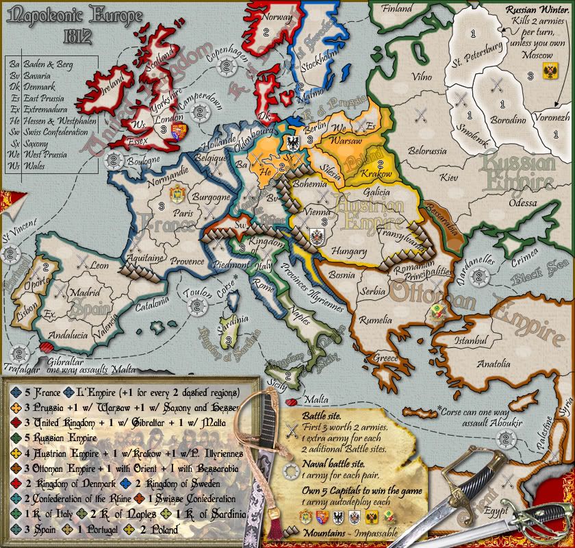
Click image to enlarge.
image


My first thoughts:

  • russian winter can't be done
  • swords cover some text and necessary informations
  • it's possible to have a more organized legend (same thing ou did with third crusade map)?

I have to think about bonuses and numbers, more comments come soon

Nobodies ;)
User avatar
Sergeant 1st Class thenobodies80
 
Posts: 5400
Joined: Wed Sep 05, 2007 4:30 am
Location: Milan

Re: Napoleonic Europe 1812 (an original idea from Raskholnikov)

Postby Industrial Helix on Sun Oct 11, 2009 8:29 am

It's not that I don't like the swords, I think they're quite cool, but they interfere with Egypt. I think you could find a better place for them or maybe scoot them in some.

I second on the mountains. It's not that they're out of place gameplay wise, but graphically they don't fit in all that well.

I think the swords might need some sort of dark backdrop to make them stand out more.

I don't really care for the ship wheel in a circle for the naval battle site. Perhaps two ships or something would be cooler?

Move the swords in Rumelia south so they don't conflict with the words of Ottoman Empire.

Where's Orient for the Ottoman Empire?

Gibraltar's one way attack of Malta and Corse -> Aboukir should use the same graphical scheme.

I like how the sea battles are a start neutral, as if you have to do something to earn the use of the sea passage.

I think it would be appropriate to add a capital for Spain.

Ok, I saw the Dardenelles in the Black Sea and did some quick reading on the Dardenelles during the war. Looks like there was in fact a battle there and the Dardenelles played their historic and timeless role of whether or not to keep them shut or open and to whom should they be open. I highly recommend and request that a sea route through the Dardenelles to connect with the battle site, it would not be true to the wars if it wasn't there.

More later, I suppose, I'm looking forward to an update!
Sketchblog [Update 07/25/11]: http://indyhelixsketch.blogspot.com/
Living in Japan [Update 07/17/11]: http://mirrorcountryih.blogspot.com/
Russian Revolution map for ConquerClub [07/20/11]: viewtopic.php?f=241&t=116575
User avatar
Cook Industrial Helix
 
Posts: 3462
Joined: Mon Jul 14, 2008 6:49 pm
Location: Ohio

Re: Napoleonic Europe 1812 (an original idea from Raskholnikov)

Postby Kabanellas on Sun Oct 11, 2009 12:05 pm

Hi guys, thanks for the critics.

Andrew:
-I'd like to avoid having that extra sea link in the Med, I prefer to text it
-I’ll change Poland’s colour so it won’t blend with the orange from Prussia and the yellow from Austria.

Nobodies:
-we’ll keep the winter but without the link to owning Moscow
-I’ll rearrange swords position
-I’ll try to sort something out concerning the legend

Helix:
-I know what you mean, they could have a more hand drawn look. But I kinda wanted them this way, like if they were symbols dropped on the map. The same is happening to the battle site symbol…. It makes them stand a bit more.
-what you do mean with ‘sort of dark backdrop’
-as for the naval battle symbol – I wanted to keep it fairly simple so I used a navigational compass…. but I’m open to change it
-I’ll change Rumelia’s battle site
-Orient represents Palestine and Egypt – it has the same colour of the OE but with a dash
-I couldn’t fit in Corse what I did with Gibraltar so I had to come up with another way. I find it quite perceptible, though I recon it’s not the same method.
-About Spain – I must say that Raskholnikov wanted it as well :). I’m totally against it. Spain had not the same influence in this war scenario as all the other powers represented here did. In fact Spain had a puppet government by that time – so I couldn’t have Madrid worth the same as Paris, London or Vienna.
-I didn’t quite get what you wanted me to do with Dardanelles :oops: – linking it to Istambul?
-I’ll change the region name from Essex to Sussex.

Thanks again, and I’ll be posting an update soon!
Major Kabanellas
 
Posts: 1482
Joined: Fri Feb 27, 2009 12:21 pm
Location: Porto, Portugal

Re: Napoleonic Europe 1812 (an original idea from Raskholnikov)

Postby Raskholnikov on Sun Oct 11, 2009 1:45 pm

I think the swords might need some sort of dark backdrop to make them stand out more.

I don't really care for the ship wheel in a circle for the naval battle site. Perhaps two ships or something would be cooler?

Move the swords in Rumelia south so they don't conflict with the words of Ottoman Empire.

Where's Orient for the Ottoman Empire?

Gibraltar's one way attack of Malta and Corse -> Aboukir should use the same graphical scheme.

I like how the sea battles are a start neutral, as if you have to do something to earn the use of the sea passage.

I think it would be appropriate to add a capital for Spain.

Ok, I saw the Dardenelles in the Black Sea and did some quick reading on the Dardenelles during the war. Looks like there was in fact a battle there and the Dardenelles played their historic and timeless role of whether or not to keep them shut or open and to whom should they be open. I highly recommend and request that a sea route through the Dardenelles to connect with the battle site, it would not be true to the wars if it wasn't there.


Swords: I think he means some sort of a black shadow to make the swords stand our more.

Ships: The.killing.44 had proposed something like this when we were working together. The problem is space and clarity. I think Kab's solutions is simpler and more elegant. Any other opinions on this?

The battle of Ruse:
the placement of the swords represents an actual battle site and cannot just be located anywhere within a territory. The swords in Rumelia represent the battle of Ruse, which forced the Ottomans to capitulate in 1812 and ended the 1806-1812 Russo-Turkish wars. They can't just be moved somewhere else. Maybe Kab can move the Ottoman Empire name slightly south so it won't touch the battle sign anymore.

Madrid: I fought for this, but in the end Kab prevailed, so I will stand by the end result as long as he does.

Orient: you mean that, for the Ottoman Empire, Egypt and Palestine are South, not Orient. True. But this is a French map. Napoleon's campaign was entitled "La Campagne de l'Orient" (The oriental campaign) for the obvious reason that Egypt and Palestine are in the Orient wrt France. That's why we called the region "Orient": we adopted a French perspective on a French map.

Gibraltar / Malta: I think he means using a star for Gibraltar / Malta as we used for Corse / Aboukir. Actually, two stars so it won't be confusing - or another symbol altogether. I'd go for one start for Gibraltar / Malta and two stars for Corse / Aboukir for available space reasons.

Neutral Naval battles: Yes, we do too. It also makes the UK by necessity a power that will develop slower, but a) is well protected from invasions and b) when it does develop, later in the game, it will bring quite a punch - as happened, indeed, historically.

Dardanelles: I agree and I actually proposed this too. What is meant is for the line connecting the battle symbol to Turkey to actually start at the point south of Istanbul where the Dardanelles actually are, and draw it through the straights to connect with the Naval Battle symbol. To continue protecting Istanbul, a minor border change for the Istanbul Territory would be necessary, as I drew it on the last map draft I sent you, Kab, before we came up with version 21. If you can't find it let me know and I will resend.
User avatar
Private Raskholnikov
 
Posts: 638
Joined: Fri Sep 11, 2009 3:40 pm

Re: Napoleonic Europe 1812 (an original idea from Raskholnikov)

Postby Raskholnikov on Sun Oct 11, 2009 2:08 pm

Kab,

I would like to propose a few minor alterations to improve historicial and geographical accuracy:

Extremadura:
please switch the name of the territory and the swords symbol around, so the swords are south, where the Siege of Badajoz was.

Leon: please place the swords symbol in the south-west corner, right next to Porto, where the Battle of Salamanca was.

Piedmont: Please move the name of the territory under the mountains and the battle symbol in the south-east corner, where the Battle of Marengo was (if possible and clear / might pose space problems).

Vienna:
please switch around the Austrian coat of arms shield and the number circle, so the shield is where Vienna actually is - like we did with all other capitals. Please move the swords symbol as close to the northern border of the territory as possible, to reflect the Battle of Wagram.

Hessen:
please put the swords where the territory army indicator circle is now and the circle in place of the swords, in order to more accurately place the Battle of Jena.

Palestine:
please move the swords a bit higher, in the centre of the territory, to reflect the geographical location of the Battle of Accra.

All the swords location changes are really very minor and for the game purposes totally irrelevant. Do them only if possible, if you wish to improve the historical accuracy of the map.

I also have two related queries:

Land Battles names: I would very much like to find a way to indicate the name of the Land Battles the way we did with Naval Battles. Clearly we can't do this on the map for both space reasons and for conceptual reasons (Naval Battles are actually sea territories, whilst Land battles are sites located within differently-named territories. But it would improve the accuracy an interest of the map to somehow capture this information. Any ideas, anyone?

Land and Naval Battles Year:
I would also like to add the dates (ie the year) of both Land and Sea Battles. Any thoughts how this could be done?

Thanks to all for your comments and criticisms and especially to Kab for actually finding the time and way to implement the proposed changes.
User avatar
Private Raskholnikov
 
Posts: 638
Joined: Fri Sep 11, 2009 3:40 pm

Re: Napoleonic Europe 1812 (an original idea from Raskholnikov)

Postby Industrial Helix on Mon Oct 12, 2009 10:38 am

Yeah, add a dropshadow to the swords.

Gotcha on the battle sites, I'd say move the words then.

Madrid: Well, you've got an objective of own 5 capitals to win and there are 6, it seems like if you've going to go over then it should be by more than 1. Plus, the Peninsular war was a major part of the Napoleonic wars, I believe Napoleon's bro was king there. Fighting there was a large contribution to the collapse of the Empire. I think it really needs to be reconsidered as a capital territory.

Orient: I see why it was named Orient, I just couldn't find it on the map. Now I realize why, the sword handle is covering it up. I'd suggest moving it around.

Dardenelles: I really think this will improve the map, looking forward to it in the next update.
Sketchblog [Update 07/25/11]: http://indyhelixsketch.blogspot.com/
Living in Japan [Update 07/17/11]: http://mirrorcountryih.blogspot.com/
Russian Revolution map for ConquerClub [07/20/11]: viewtopic.php?f=241&t=116575
User avatar
Cook Industrial Helix
 
Posts: 3462
Joined: Mon Jul 14, 2008 6:49 pm
Location: Ohio

Re: Napoleonic Europe 1812 (an original idea from Raskholnikov)

Postby Kabanellas on Mon Oct 12, 2009 5:50 pm

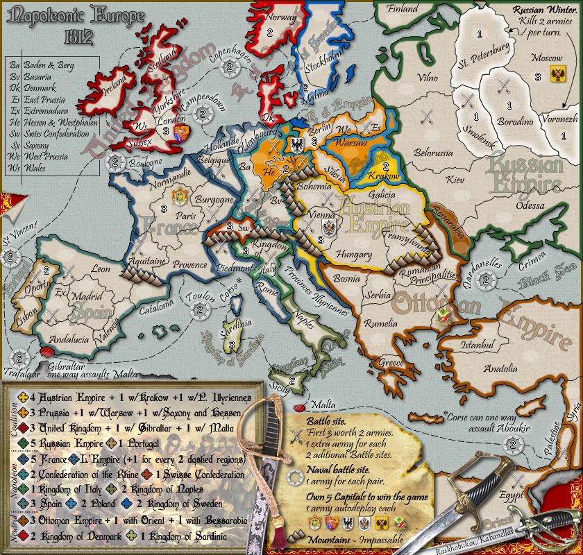
Map update:

-swords position changed
-legend reorganized by nobodies request – working great now!
-and a lot of other stuff more :)

Version 22
Click image to enlarge.
image
Major Kabanellas
 
Posts: 1482
Joined: Fri Feb 27, 2009 12:21 pm
Location: Porto, Portugal

Re: Napoleonic Europe 1812 (an original idea from Raskholnikov)

Postby captainwalrus on Mon Oct 12, 2009 8:26 pm

Version 22?

I'll say more later, but I think it looks a little smushed and crowded. I liked .44's better, but that is neither here nor there.
~ CaptainWalrus
User avatar
Private 1st Class captainwalrus
 
Posts: 1018
Joined: Sun Nov 11, 2007 3:19 pm
Location: Finnmark

Re: Napoleonic Europe 1812 (an original idea from Raskholnikov)

Postby Raskholnikov on Mon Oct 12, 2009 9:32 pm

Walrus,

Thanks for your comments.

As you can see at the start of the thread, it took 21 iterations until we developed a version we were happy to share with all of you. So version 21 became the first version displayed publicly, and this is the first public revision - so version 22... ;)

Do you have any suggestions to help us make it look less "smushed and crowded"? We look forward to your -and anyone else's- comments, criticisms and alternate drafts.

Many thanks,

Raskholnikov
Last edited by Raskholnikov on Tue Oct 13, 2009 10:45 am, edited 1 time in total.
User avatar
Private Raskholnikov
 
Posts: 638
Joined: Fri Sep 11, 2009 3:40 pm

Next

Return to The Atlas

Who is online

Users browsing this forum: No registered users