This map looks gorgeous.. the mountains look like they were done individually. It'll get quenched, probably with no graphic adjustments.
I'll just throw around some gameplay suggs I guess...
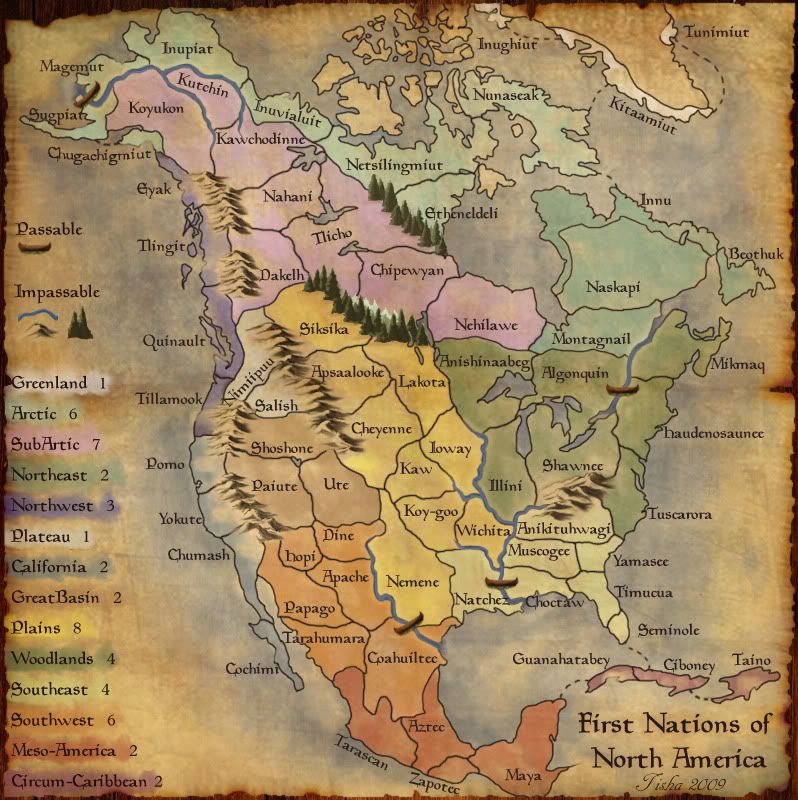
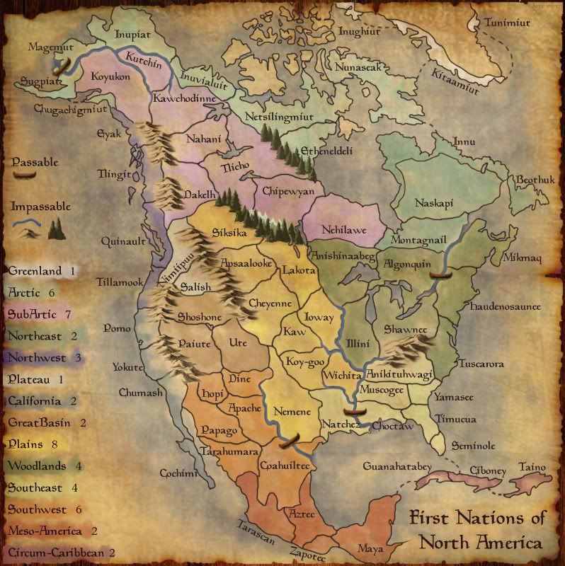
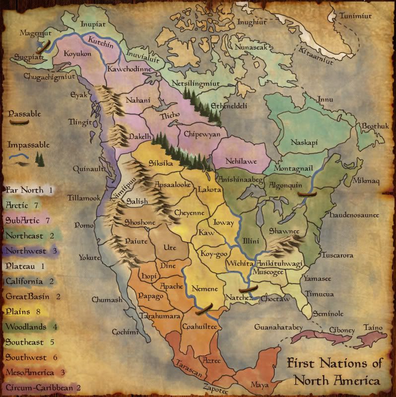
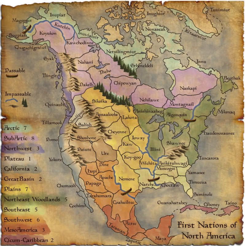
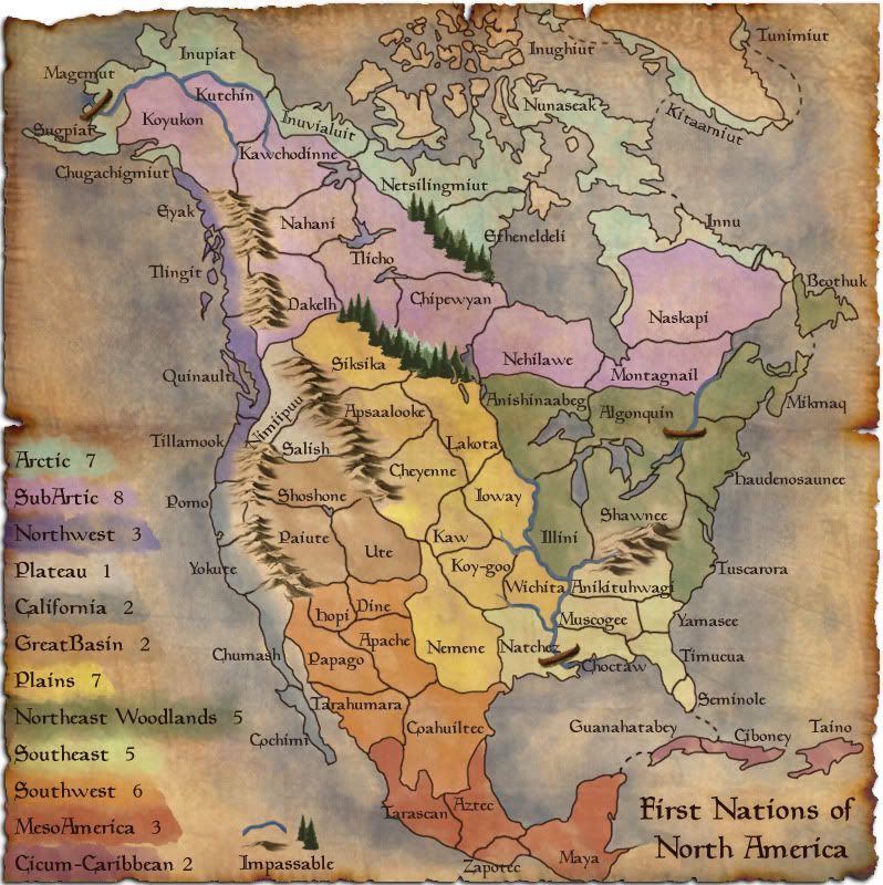
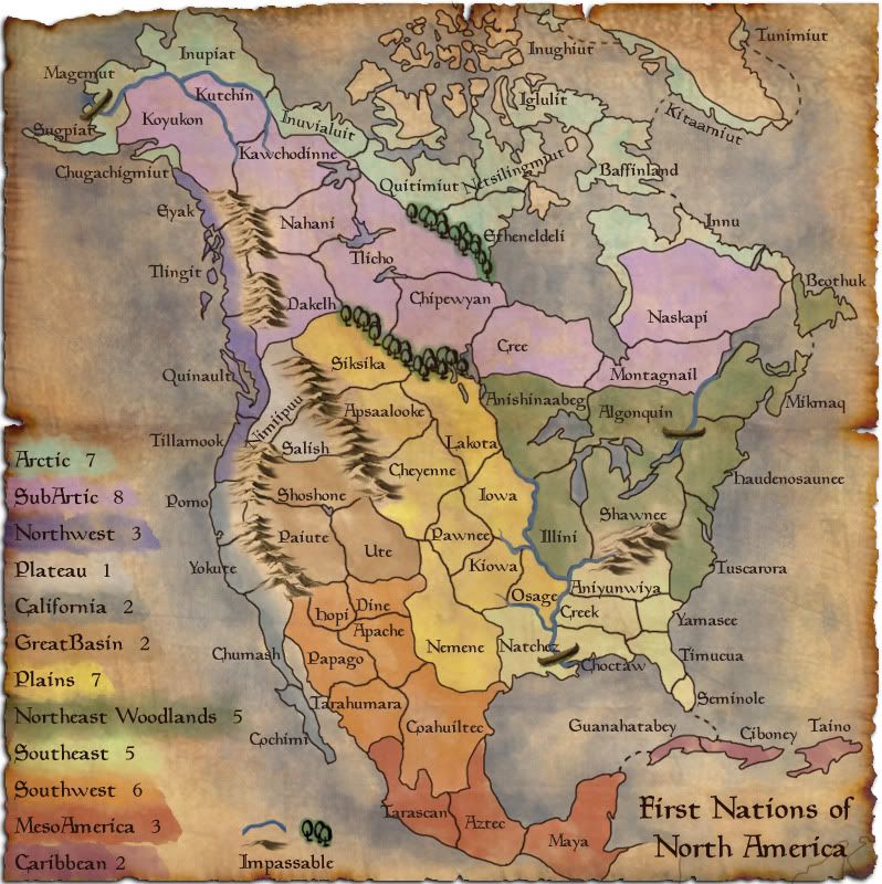
Bones2484 wrote:I absolutely love the map, but I'm not too sure what the point of all the northern territories are? Everything else seems to be segregated by a group of Native tribes. Up North you started using names of the territories?
It just seems like you started putting in territories for the sake of territories and lost the "theme" of the map. Personally, I'd just take out each of the arctic territories and it still works great.
Agreed.
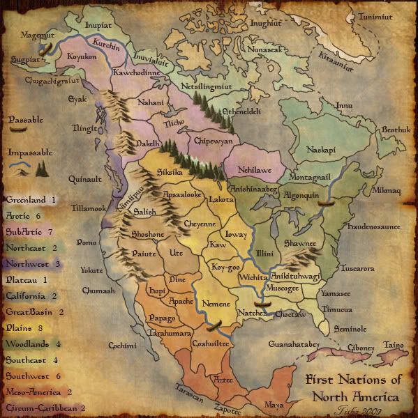
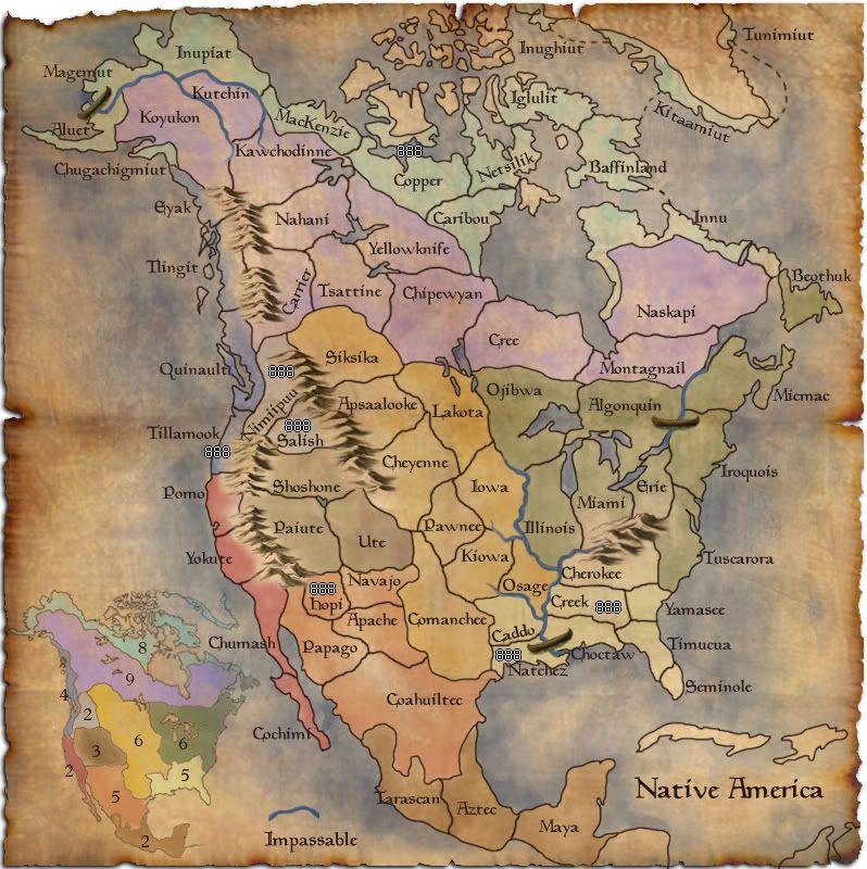
The Neon Peon wrote:I see what you mean with the Mississippi, though. Two solutions for the west: (which looks a bit odd right now)
1. Make the river define territory boundaries as you did up north in Alaska.
2. Scrap the rivers entirely since there are only 3 on the map and they are not impassable.
(Overall, I'd go with the first option.)
Agreed. The map could probably use more impassables anyways... maybe the Ohio, Missouri, and Mississippi rivers. Of course, that is silly based on the theme... I dunno, but these rivers were very important, so somehow making them more prominent can't hurt.
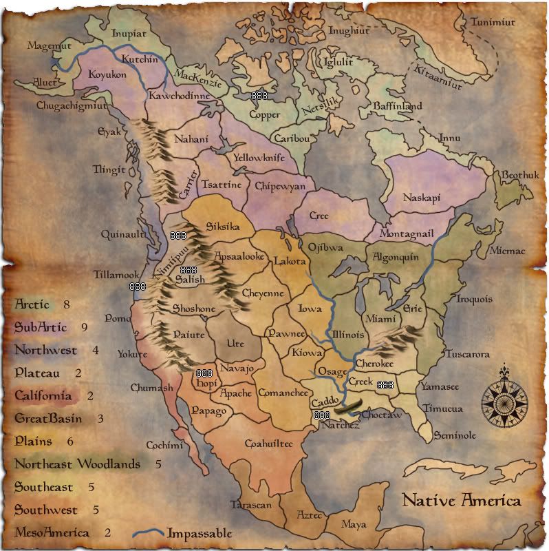
The Meso America and Plateau bonus seem pretty easy to get compared to the others, don't they? And you have more bonuses than regions, which I'm sure that you noticed.
Beothruk(Northeast Woodlands) is connected to Labrador?
Are you including Cuba/Caribbean?
How accurate from a historical standpoint are the territories? Some seem a slight suspect, but I don't know enough about the other tribes in the 1500s to say for certian.

(just wondering)


