iancanton wrote:i've a feeling that the surfside and dionis names are anachronistic, but we can fix these in due course if and when we find more appropriate names.
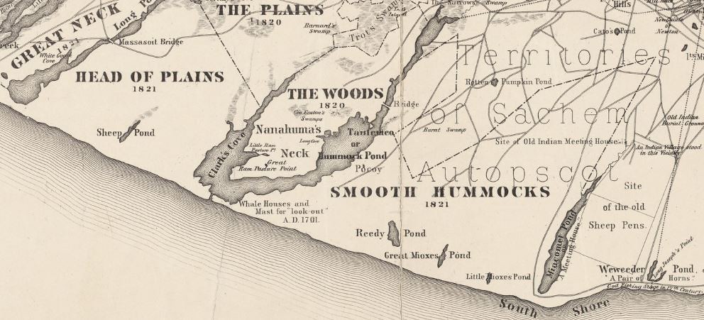
I just took a very close look at all the old maps. "Surfside" first appears on a 1921 map. No region/neighborhood name appears before that but on maps from 1838 to 1891 two small ponds are shown along the south coast in the area of our tert. One is named "Weweeder Pond" (in one later map "Weedweeder") and the other is "Nobadeer Pond". I think we could adopt either (minus "pond"). They're both quite cute.
Dionis tert has the following possible alternatives: 1775 and 1776 maps: "Capum Pond" is near the north coast 1782 and 1791 maps: Sherburn. From Wikipedia: "Before 1795 the town on the island was called Sherburne. The original settlement was near Capaum Pond. At that time the pond was a small harbor, whose entrance silted up, forcing the settlers to dismantle their houses, and move them northeast by two miles to the present location." I've studied Google maps. About two miles west of the current town there are three small ponds. They lie, as best I can tell, along my border between Dionis and Sunset Hill. So I think we'd be okay changing Dionis to either Sherburn or Sherburne. But if you want to get technical, this actually would be confusing, since the town itself was called that at the time of our scenario and our town is at "Docks". The 1801 map shows a "Capam Point" on the coast where Capum (or Capuam) Pond was. The 1838 map names three ponds up there but also has a name inland, near the south of our tert: "Cambridge." Also, a bit closer to the east arm of that tuning-fork-shaped pond: "The Woods". The 1858 map, the first to show extensive roads or trails, depicts Cambridge as a sort of village or crossroads. 1869 also shows Cambridge, a bit farther north closer to the center of our tert.
That's all I could glean from the antique maps available at
http://www.old-maps.com/ma/ma_CoBDN_Nantucket_TownMaps.htm. I've searched for other old maps but that website seems to be comprehensive.
Now as for "Dionis" itself, it is now the name of both a neighborhood and a beach. I have found three relevant references. The neighborhood appears to have been named in the 1880s or 90s by a real estate developer. Also around this time a locomotive used on the island's narrow-gauge railway was named Dionis. I don't know if the beach name extends farther back but I expect it might. Most relevant, perhaps, for us is the origin of the name itself. First, from Wikipedia:
Tristram Coffin (or Coffyn) (c. 1609 – 2 October 1681) was an immigrant to Massachusetts from England. In 1659 he led a group of investors that bought Nantucket from Thomas Mayhew for thirty pounds and two beaver hats. He became a prominent citizen of the settlement. A great number of his descendants became prominent in North American society, and many were involved in the later history of Nantucket during and after its heyday as a whaling center. Almost all notable Americans with roots in Nantucket are descended from Tristram Coffin...
And who was this founder's wife?
Dionis Stevens. She lived to be 71 years old and had 75 grandchildren. Yowza!
Chances are the 1880's developers simply honored her by naming their subdivision after her. Using the same name on our map we might be anachronistic to a degree but I wouldn't mind honoring her as well. I recommend we either keep her name or adopt "Cambridge". And either "Weweeder" or "Nobadeer" instead of "Surfside".
iancanton wrote:the land bonuses are still big enough to make it suicidal to take ten neutrals before receiving a decent whale bonus. perhaps reducing the open sea regions to n1 might help.
Okay by me. Let's settle on some names and I'll post a revised version.


