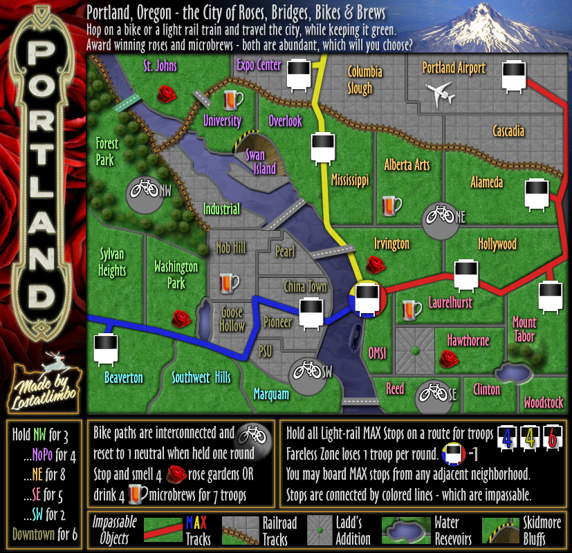
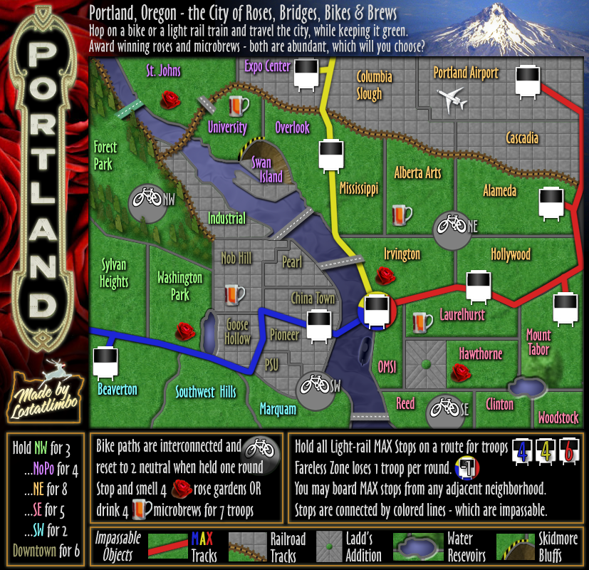
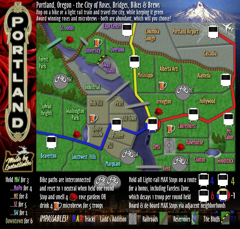
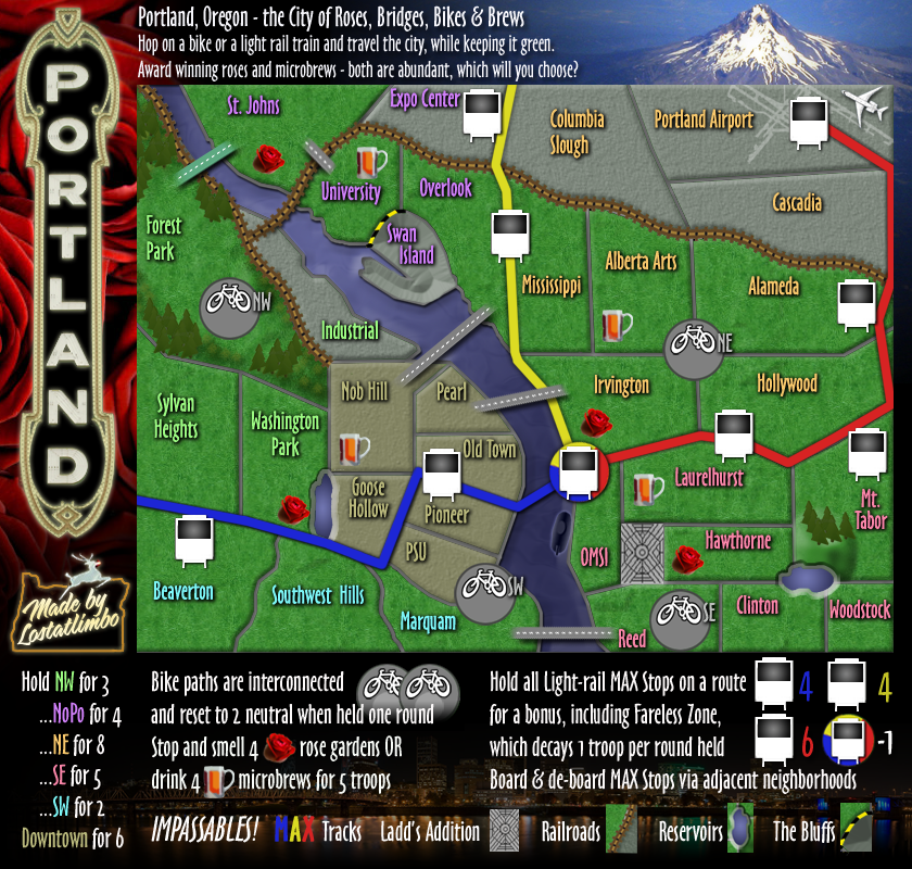
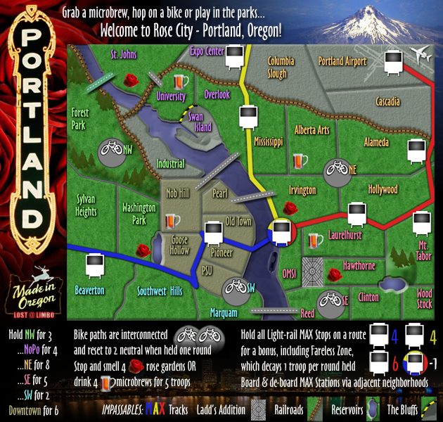
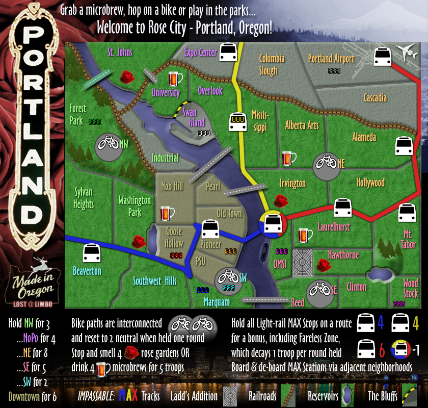
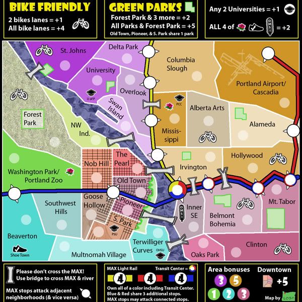
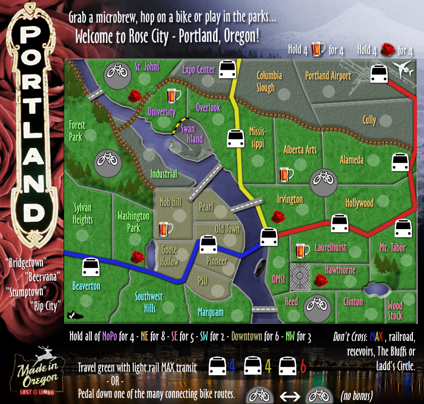
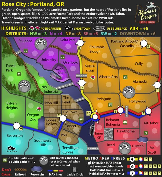
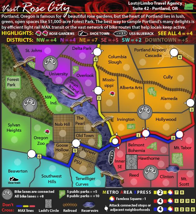
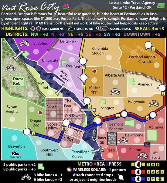
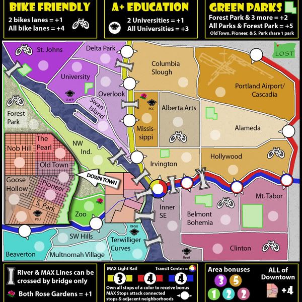
Version 50:
New trees!
Made connections in NW clearer.
Fixed legend error on bike neutrals.
- Click image to enlarge.
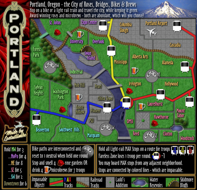
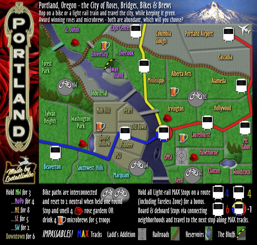
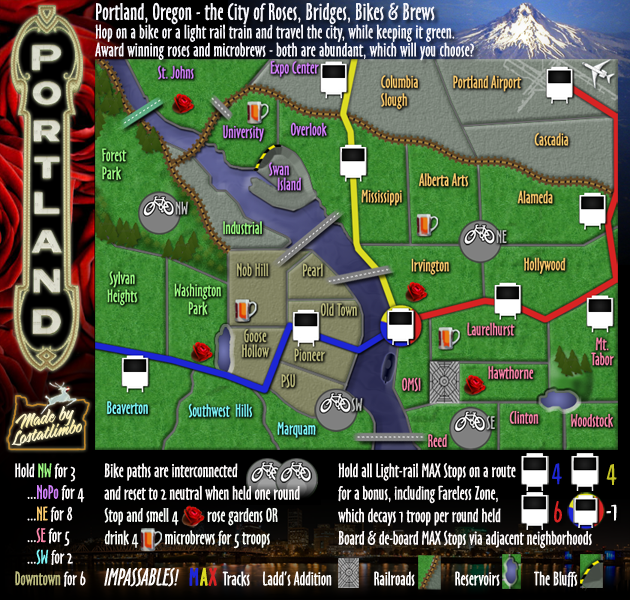
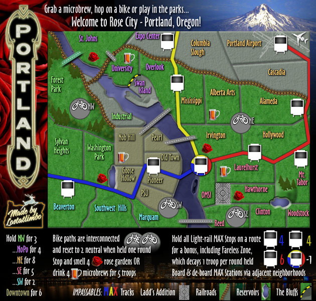
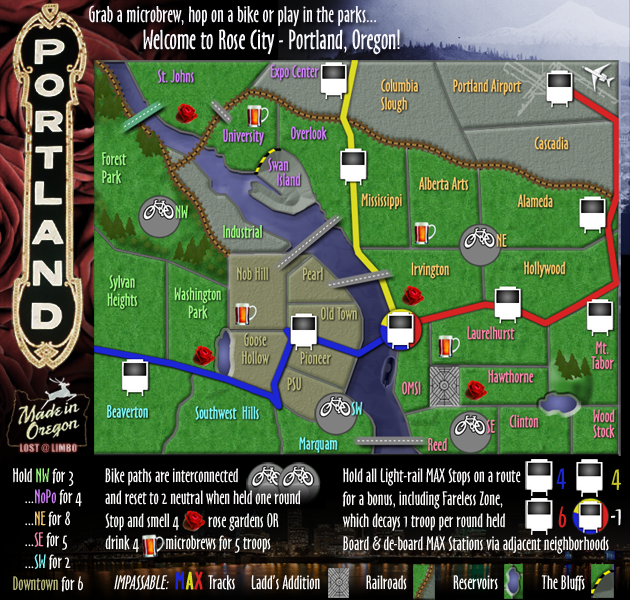
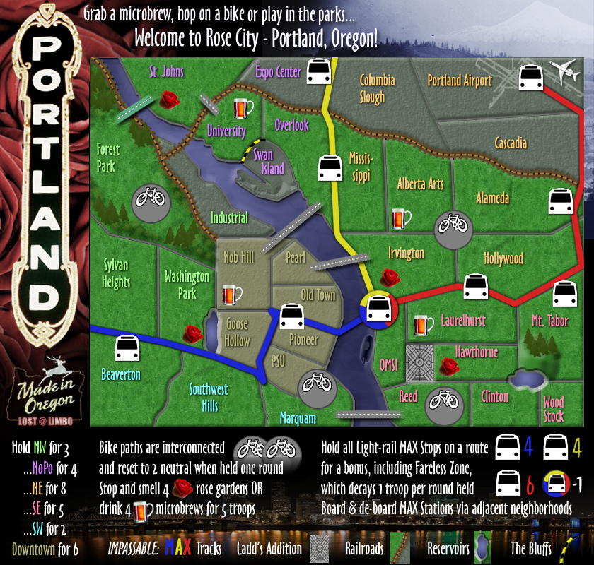
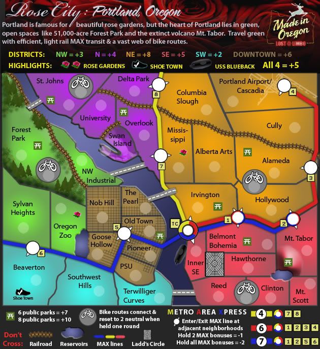
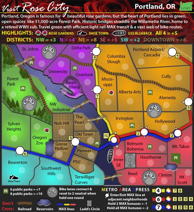
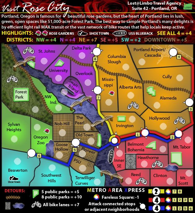
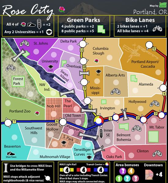
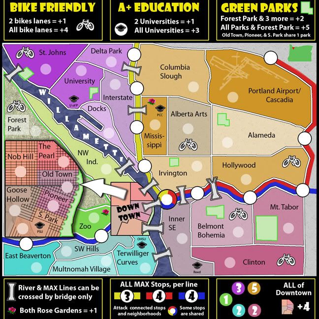
Version 49:
Made a few small tweaks and updated the XML for the large map. I know everyone is over this map, but I really think this update looks a lot better. Can I get a
little love?
- Click image to enlarge.
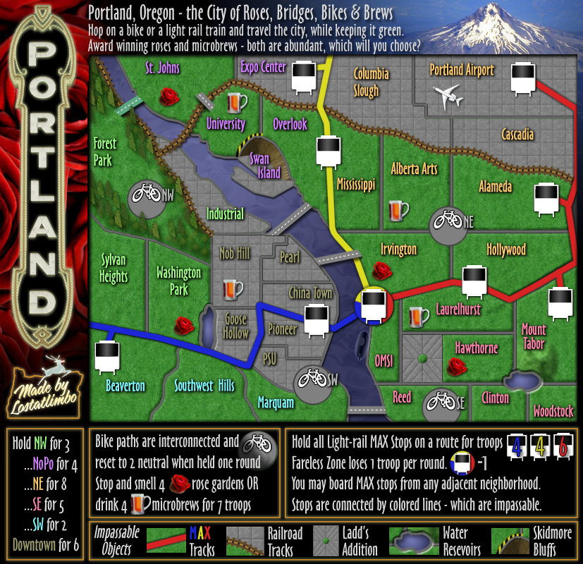
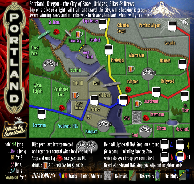
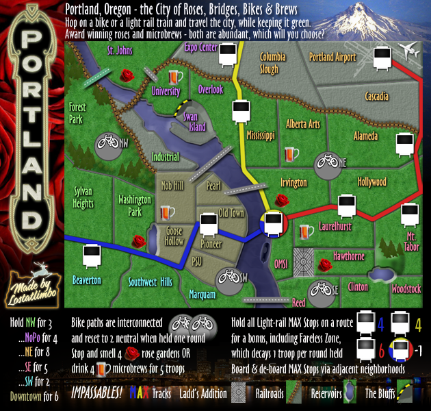
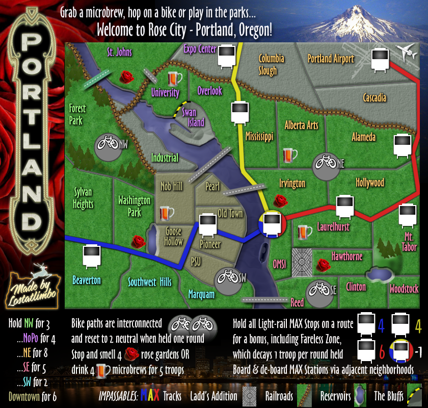
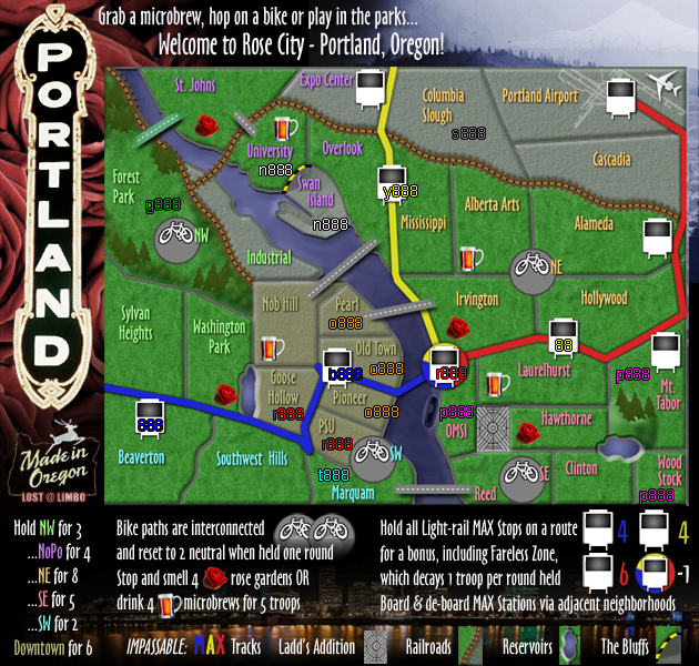
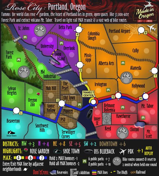
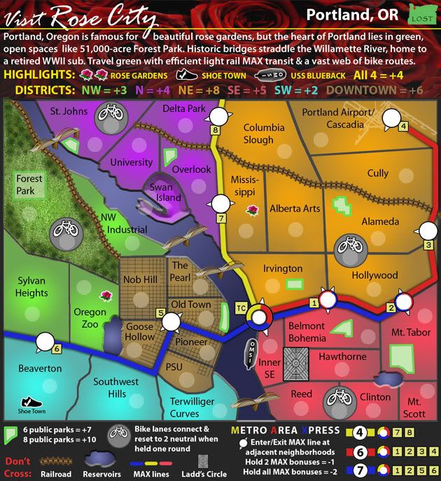
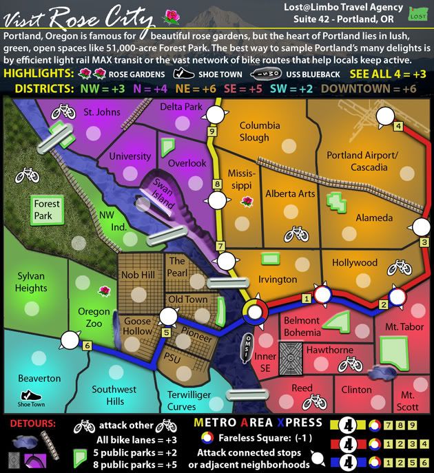
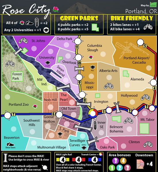
Version 48:
Made a lot of graphical touchups throughout the map - some aesthetic, some functional.
- Branched out MAX stops with only 1 connected neighborhood.
- Redrew some territory lines and added better background texture.
- Redrew Ladd's Addition.
- Tidied up the legend.
I will update the XML soon and move the MAX numbers to the white section of the stops.
- Click image to enlarge.
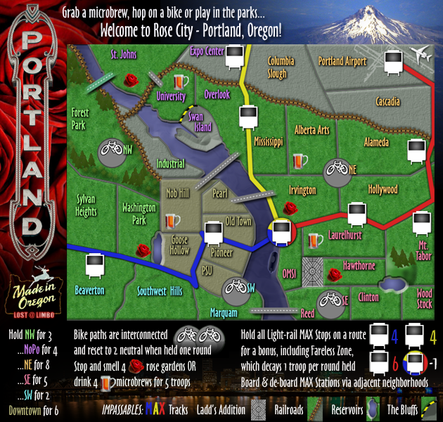
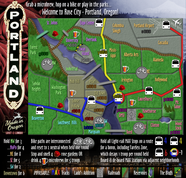
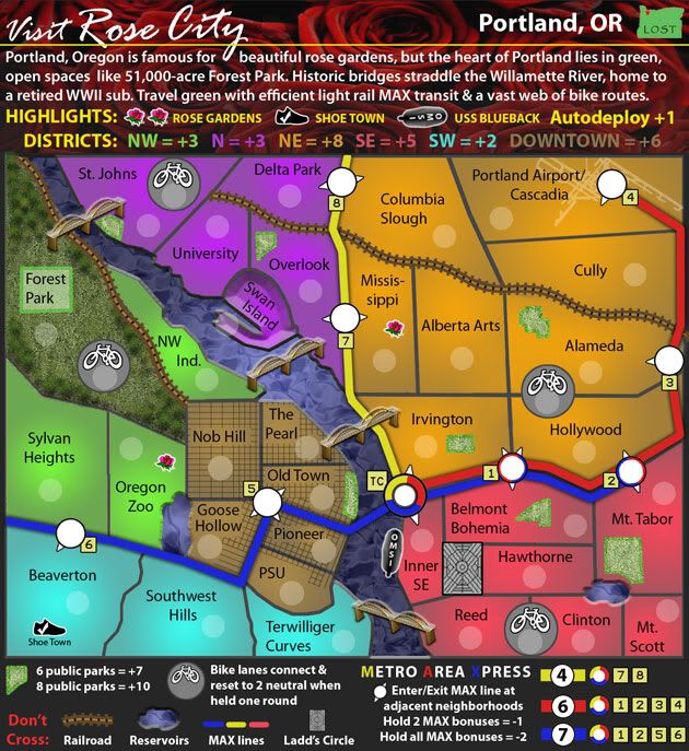
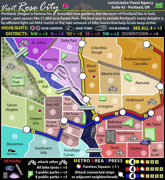
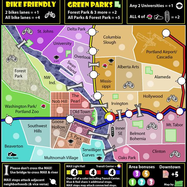
I made a few, mostly minor, graphic changes to clean things up and improve the overall look. Thoughts?
- Click image to enlarge.
Updated legend to reflect gameplay change
- Click image to enlarge.
More drop shadow on trees
XML next!

- Click image to enlarge.

Added drop shadows to roses, brews, and trees
Changed the anti-alias of the header & legend text for increased clarity
- Click image to enlarge.

Fixed header text
Also re-did Swan Island for clarity
Darkened MAX windows
Cleaned up beer icons
Fixed black spots under train tracks and other minor blemishes
- Click image to enlarge.

Changed back to Impassables
Anything left with graphics?
- Click image to enlarge.
Fixed up the sign as DiM suggested and also re-did the "Made in Oregon" sign.
Changed the bike territory names to neutral color.
I also fixed up some other minor aesthetic things that were bugging me, like the goofy blue MAX line in SW/Downtown.
- Click image to enlarge.
Played around with a few versions, but this one really grabbed me...
- Click image to enlarge.

More aesthetic changes (page 17 for details)
- Click image to enlarge.

- Click image to enlarge.

Different MAX stops work better with troop numbers?
 30th Draft
Some minor graphic tweaks to allow for better fit with troop numbers
- Click image to enlarge.
- Click image to enlarge.
Added labels to Bike Paths
Added troop number examples
- Click image to enlarge.

- Click image to enlarge.

Redesigned bridges
Clarified The Pearl border
Darkened all borders
- Click image to enlarge.
Tweaked Nob Hill <> Overlook bridge for clarity
Replaced St Johns <> University land bridge with a road bridge for style
- Click image to enlarge.

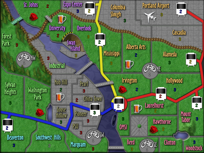
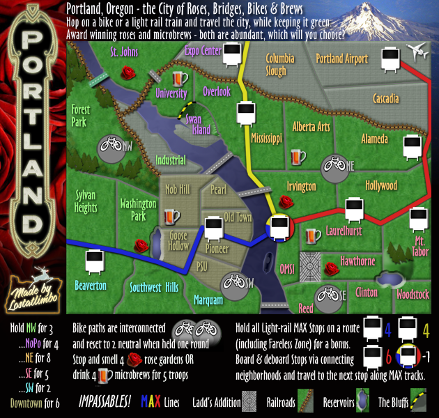
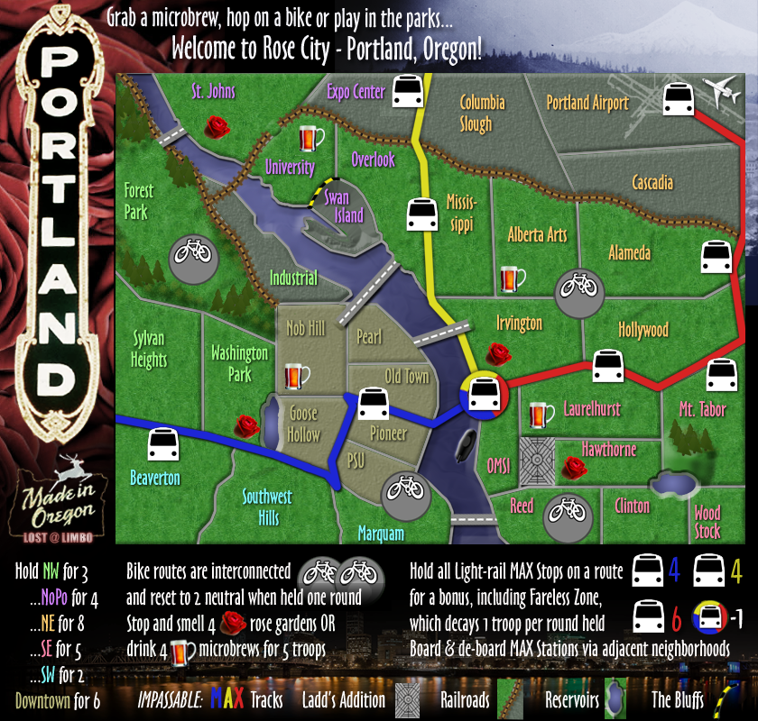
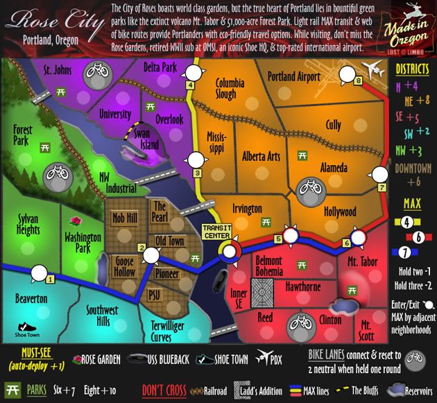
Clarified legend
Changed Fareless Zone to a -1 troop decay on that territory when held
You can now only receive a bonus for 4 roses OR 4 microbrews - not both
http://i134.photobucket.com/albums/q102 ... new3-1.png
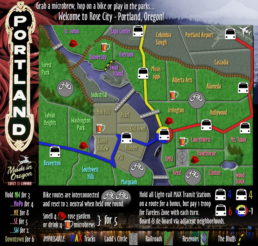
25th Draft
Mostly just
gameplay updates
http://i134.photobucket.com/albums/q102 ... new2-1.png
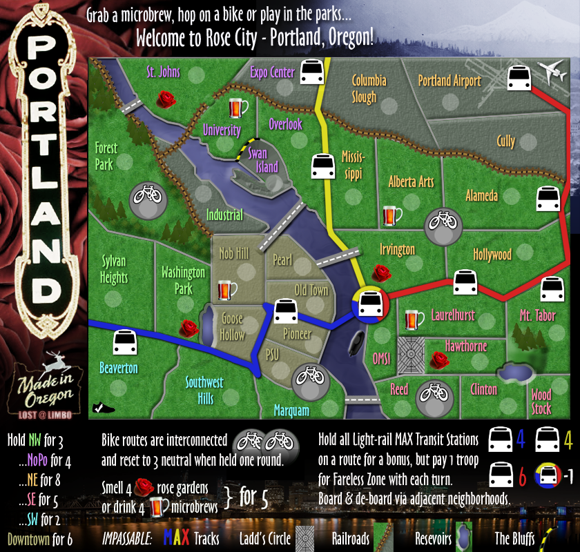
24th Draft
Legend & gameplay edits
http://i134.photobucket.com/albums/q102 ... _new-4.png
Just the biggie for now. Will post the small when this one is OK'd.
23rd Draft
Major re-design
http://i134.photobucket.com/albums/q102 ... _new-1.png
http://i134.photobucket.com/albums/q102 ... mall-1.png
22nd Draft
Dropped the buildings/boxes from Downtown, but left the background sans grid.
http://i134.photobucket.com/albums/q102 ... land27.jpg
21st Draft
Re-worked the legend again for a better layout. I think it fits together quite nicely now.
http://i134.photobucket.com/albums/q102 ... land26.jpg
http://i134.photobucket.com/albums/q102 ... 26_big.jpg
20th Draft
Tried to make this one less flat.
Found a different font I like.
Moved around the Legend.
Re-did the Downtown street grid.
Re-arranged Max stop numbers
Added the airport as a Highlight and dropped a rose garden.
Perhaps it is too late in the process, but I wanted to float the idea of the "Highlights" starting neutral and then being +1 auto-deploy when owned. Among other benefits, it makes it impossible for a player to start with the SW or NW bonuses. Thoughts on this change?
http://i134.photobucket.com/albums/q102 ... land25.jpg
19th Draft update:
Replaced Swan Island train track with caution retainer.
Tweaked drop shadow on Blue Max line
Added depth to Oregon Zoo & Mt Tabor reservoirs
Re-ordered MAX numbering
Other minor visual tweaks
http://i134.photobucket.com/albums/q102 ... land24.jpg
18th Draft update:
Fixed bridge connections
Added train track impassable and softened edge of Swan Island.
Added contour to Mt Tabor (volcano) and Forest Park
Toned down highlights for other Attractions bonuses.
Added more detail to USS Blueback submarine.
Added rose background and fancy title font back into header.
http://i134.photobucket.com/albums/q102 ... land23.jpg
17th Draft update:
Dropped new land bridges.
http://i134.photobucket.com/albums/q102 ... land22.jpg
16th Draft update:
Reluctantly dropped 3-D bridges
Added additional bridges between Overlook/Mississippi & Hollywood/Belmont
Fixed Alberta/Hollywood connection
Dropped legend background, added iconic "Made In Oregon" sign.
16.5 - cleaned up the new bridges a bit
http://i134.photobucket.com/albums/q102 ... land21.jpg
15th Draft update:
Toned down Forest Park texture more and added trees.
Converted parks into park bench icons to better match look of map.
Upped Highlights bonus by 1.
http://i134.photobucket.com/albums/q102 ... land19.jpg
14th Draft update:
Dropped auto deploy idea.
Upped N bonus by 1.
Changed "NW Ind." to "NW Industrial"
I toned down the textured elements of map - parks, bridges, waterways in an effort to minimize the visual clash. I did leave some texture in Forest Park, because I want it to be evident that the entire territory is a park, but I made it look more like a NW territory. I also lowered the bridges to make them look level and not looming over the map.
http://i134.photobucket.com/albums/q102 ... land18.jpg
13th Draft update:
Raised bonus for parks, downtown, NE & blue line MAX.
Blue line extended.
Bike lane killer neutrals lowered to 2, removed from University, Alberta, Hawthorne.
-1 bonus adjustment for holding two MAX lines, -2 for holding all three.
Testing a +1 auto-deploy on "Attractions", rather than a +4 bonus for holding all four? Thoughts?
http://i134.photobucket.com/albums/q102 ... land17.jpg
12th Draft update:
Removed Bike Lane bonus and lowered neutrals to 3 a piece - resetting if held one round.
Transit Center is now -1
only if a MAX bonus is held.
Raised MAX bonuses by 2 each.
Lowered N bonus to 3.
(forgot to actually update the image last time - oops!)
http://i134.photobucket.com/albums/q102 ... land15.jpg
11th Draft update:
- Added 4 new territories (N Bike Lane, NE Bike Lane, SE Bike Lane, Forest Park Bike Lane) in place of former Bike bonuses. These territories start 6 neutral.
Now that there are less of these and they are separate (and neutral) territories, I think its okay to have them attack each other. I like the idea of them being a way to move around the map. Neutral armies prevent them from being as detrimental as before and I've upped the bonus to 8 since it will be harder to capture and keep them.
Is it clear enough that they are connected or does this need to be explained better? Should I add 2 more territories some where for an even 48?
- I toned down some of the stronger visuals to reduce clutter. I "un-blobbed" the reservoirs to the best of my ability and flattened out various other icons.
- I added Max Lines to the Detour (Don't Cross) list and labeled these. I don't know what else to call Ladd's Circle. Road maze? If the neighborhoods don't need explanation - why this?
- I'm open to suggestions for a better legend background.
http://i134.photobucket.com/albums/q102 ... land14.jpg
10th Draft update:
Altered borders in N & NE, by extending railroad tracks to St. Johns and shrinking Swan Island.
Removed 4-way border in NE.
Dropped a Yellow Max stop and added a new territory to NE (Cully).
#6 Max stop no longer attacks Oregon Zoo.
#5 Max stop unchanged. Downtown can be defended with 4 territories either way.
Changed train and bridge graphics.
Removed ability for bike lanes to attack each other.
Fareless square starts with 3 neutral. -1 army each turn held.
http://i134.photobucket.com/albums/q102 ... land13.jpg
9th Draft update:
Does this tickle anyone's fancy?
http://i134.photobucket.com/albums/q102 ... land11.jpg
Eighth Draft update:
Completely re-drew borders for entire map.
Re-drew all Parks, Bridges, & Detours.
Added impassable 'bluffs' to Swan Island. Access only from NW Industrial & MAX stop 7. Upped North bonus to +4.
Bike lanes can now attack other bike lanes. Bonus ONLY for holding all bike lanes.
http://i134.photobucket.com/albums/q102 ... land10.jpg
Seventh Draft update:
Made significant layout changes.
Removed some MAX stops (#3 & #11 gone)
Added new territories in SE (split Belmont into Hawthorne; split Clinton into Mt. Scott).
Re-designed NW & SW (removed Multnomah Village; added Sylvan Heights)
Re-routed Blue Line MAX through Downtown.
Added impassables (Railroads dividing territories in N, NE & NW; water (a reservoir) & an obstruction in SE).
(Debating on how to signify these in the legend)
Restructured Park & Bike bonuses and District bonuses according to re-structuring.
REMOVED "School" bonus completely.
Re-colored Downtown.
Re-did legend.
Seventh Draft addendum:
Extended NE railroad and raised bonus to +6
Added "Detours" section to legend to show impassables.
Changed SE reservoir image to look more like a body of water
(Just the smaller version this time:)
http://i134.photobucket.com/albums/q102 ... tland9.jpg
http://i134.photobucket.com/albums/q102 ... tland8.jpg
Sixth Draft update: Made some very minor changes - chose clearer font for MAX stop markers. Toned down some of the stronger fonts in the legend. Made SE pinker (per Astoria's suggestion).
http://i134.photobucket.com/albums/q102 ... -Map_7.jpg
Fifth Draft update: Forest Park is no longer required for a park bonus - now all parks are equal. Moved some bonuses around for a more even spread. Added #s to all MAX stops (except Transit Center). Altered some bonus amounts for consistency. Also added some texture to Forest Park and a map header and toned down Downtown's road grid for look and style improvement.
http://i134.photobucket.com/albums/q102 ... hdraft.jpg
Fourth Draft update: Made some minor changes regarding coloration. I've also eliminated the confusing park situation in Downtown. Now only "Old Town" is a 'park territory'. I've changed Forest Park's border color to signify that the entire territory is indeed a park.
http://i134.photobucket.com/albums/q102 ... hdraft.jpg
Third Draft update: Made some significant layout changes, based on feedback from oaktown and others. Downtown now exists within its real boundaries, rather than as an inset. There are now 42 territories (rather than 41) for better gameplay. The connection from the Transit Center to Downtown is much clearer, as is the contents of the NW bonus. I've also added "Shoe Town" and "OMSI" to the map and included them as a bonus package with the Rose Gardens.
Third Draft
Second Draft update: I've re-sized these both to the proper limitations and added more detail to the MAX stops for clarity, as well as a thin connecting line through Downtown from the Blue Line Zoo/SW Hills stop to the Rose Garden Transit Center. This one may still be confusing, so I'm open to suggestions. The Zoo/Hills stop should be able to attack the Transit Center and vice versa. There's also so very minor name and boundary changes.
Second Draft (link)
First Draft (link) 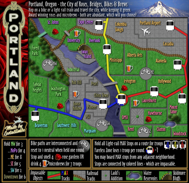


