Moderator: Cartographers
iancanton wrote:if we are not to consider 33, then i prefer 36 or possibly 37 (maximum of two neutrals) or 40 (maximum of one neutral unless 6 are playing).
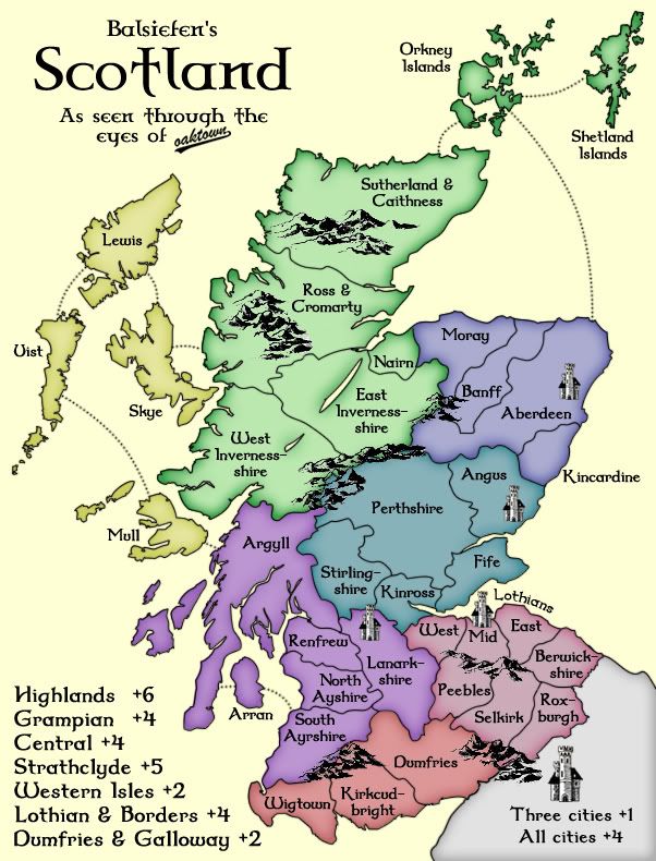
Balsiefen wrote:CURRENT MAP
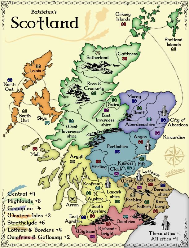
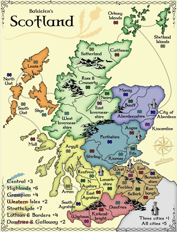
ScotlandOaktown V2.4
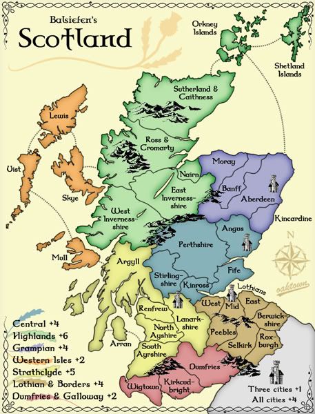
oaktown wrote:small map, 457x600:
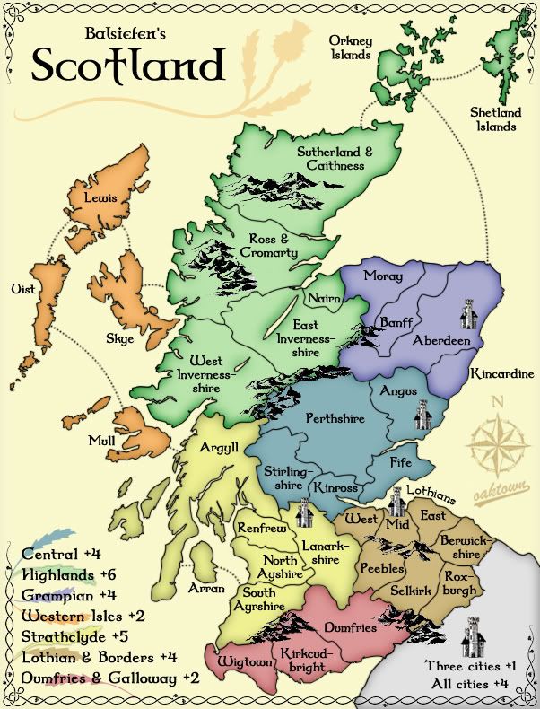
Large map, 602x790:
So, I've changed up the colors a bit... as a colorblind user I find this color scheme to be more friendly.
Also, first stab at small map. It'll take some work fitting in army counts, but it's doable.iancanton wrote:here's another idea: rather than adding three territories, how does deleting three compare (i think the natural mergers are reuniting ayrshire, reuniting inverness-shire and combining argyll with mull, as mull was always part of argyll and not part of the western isles)?
You would only have to delete one territory to avoid the first turn advantage, but fewer than 36 territory makes for thin starts in larger games. It's worthy of further discussion.
Balsiefen wrote:Sorry i havn't looked for a bit but i've been having an awful few days.
Anyway, i'm afraid i'm a litytle out of touch. How do certain amounts of territories delete first turn advantage? Personally, i'm with oaktown for size. I would prefer a medium sized map to a small one.
Anyway, glad to see people have taken an inerest and i'll try to make more useful desisions once i have more time and have got my bearings
natty_dread wrote:I was wrong
Balsiefen wrote:split uist-could be good but it leads to having a 2 bonus for 5 terrs while dumfries has 2 bonus for 3 terr so we would have to change that somehow (islands boosted to 3 bonus?)
Balsiefen wrote:I agree. Looking at it, i think clack looks about the most cramped, especially as the name doesn't fit. I think we could lose it quite happily from a gameplay point of view but from the maps i've seen, i've never seen kinross there. Does anyone know if it is still correct?
oaktown wrote:Clackmanshire seems to me to be the most obvious drop, leaving us with a nice round 40.
Balsiefen wrote:I still think our best bet is to drop clack for now as thats the most cramped.
Balsiefen wrote:Does anyone think we should take strahclyde up to 7 or keep it at 6? For referance, classic map asia has 12 terrs with 4 boarders, Strathclyde has only 8 terrs but 5 boarders and is in a bottleneck between north and south
oaktown wrote:finalize bonuses... are we upping the cities to +5?
iancanton wrote:oaktown wrote:finalize bonuses... are we upping the cities to +5?
this looks necessary to keep the cities relevant. now that the city of aberdeen is no longer adjacent to angus, a player needs to conquer four extra territories to gain the cities bonus if he doesn't want his forces to be isolated.
finally, swap the names of east ayrshire and south ayrshire with each other!
ian.
iancanton wrote:finally, swap the names of east ayrshire and south ayrshire with each other!
edbeard wrote:could you maybe switch the orange with one of the blues just to avoid any confusion?
I know there's a few clues since the name of one of the continents is central, but unless there's a good reason for the two blues (I know that one is more purple and the other more grey/teal) to be right next to each other, idiot proofing the map is almost never a bad idea.
edbeard wrote:that would probably work. My problem is on the legend mostly. The blues aren't as distinguishable to me there.
oaktown wrote:I also took the liberty of dropping Central to +3... with only three borders and five territories it is now smaller than Africa in the Classic map, so in my opinion not worthy of a +4.
iancanton wrote:oaktown wrote:I also took the liberty of dropping Central to +3... with only three borders and five territories it is now smaller than Africa in the Classic map, so in my opinion not worthy of a +4.
that's a strong argument!
this 1892 (!) map from the national library of scotland website shows the kincardine-aberdeen border following the river dee exactly. the city of aberdeen is located on the north bank of river dee where it meets the sea. shall we make kincardine adjacent to the city of aberdeen, as implied by the 1892 map, if only to make the shape of aberdeenshire look less contrived?
http://www.nls.uk/maps/early/scotland.cfm?id=780
there's a missing r in north ayrshire.
the sea routes look ace compared with numerous attempts on other maps that i've seen.
ian.
Users browsing this forum: No registered users