Mapmaker(s): Minister X
Number of Territories: TBD
Special Features:TBD (perhaps special river-crossing rules)
What Makes This Map Worthy of Being Made: See below.
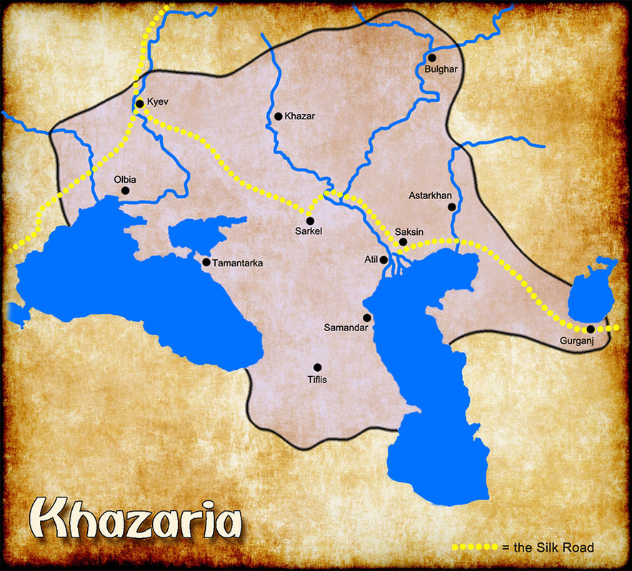
Map Image:

From Wikipedia (edited a bit):
The Khazars were a semi-nomadic Turkic people with a confederation of Turkic-speaking tribes that in the late 6th century CE established a major commercial empire covering the southwestern section of modern European Russia. [MY MAP SHOWS THEIR TERRITORY CIRCA 850 AD AT THE HEIGHT OF THEIR EXPANSION.] The Khazars created what for its duration was the most powerful polity to emerge from the break-up of the Western Turkic Khaganate. Astride a major artery of commerce between Eastern Europe and Southwestern Asia, Khazaria became one of the foremost trading empires of the medieval world, commanding the western marches of the Silk Road and playing a key commercial role as a crossroad between China, the Middle East and Kievan Rus'. For some three centuries (c. 650–965) the Khazars dominated the vast area extending from the Volga-Don steppes to the eastern Crimea and the northern Caucasus.
Khazaria long served as a buffer state between the Byzantine Empire and both the nomads of the northern steppes and the Umayyad Caliphate, after serving as Byzantium's proxy against the Sasanian Persian empire.
...the state was polyglot and polyethnic. The polyethnic populace of the Khazar Khaganate appears to have been a multiconfessional mosaic of pagan, Tengrist, Jewish, Christian and Muslim worshippers.
I researched every map I could find of this fascinating state. They differ substantially, due, I imagine, in part to changes over time and in part to great uncertainty about names, locations, and whatnot. None show any internal borders so we are free to invent our own, using the cities and rivers and whatever else strikes our fancy.
I'm thinking that ownership of stretches of the Silk Road should be an important goal. I may or may not include areas/people just outside the state such as Byzantines, Khwarizm, Jurjans, Hungarians, and Rus. One special feature I'd love to include if the coding would support it is a penalty for crossing rivers. Is it possible to code something like a 20% reduction in armies (rounded up)? Alternatively, or in addition, is it possible to code some sort of attack disadvantage when attacking across a river? I'm interested in this because these are large rivers, I presume they were unbridgable in 850 AD, and a few archers on the opposite bank could do some real damage to those in the rafts and boats attempting a crossing. Actually, bridges might well have been possible but I doubt there were many and I doubt they were permanent.
Based on the Oasis map I see that I can create a chain of terts following each river and troops in those terts suffer a decline each turn but that's a mediocre substitute for what I'm hoping for. (I'd want no penalty for crossing via the Silk Road, thus enhancing the value of that critical thoroughfare.) Can anyone point me to other maps that might have features along these lines that I can learn from?
BTW: It's a near certainty that some of my ancestors were Khazars.
Here's a pic of a Khazar horse archer:

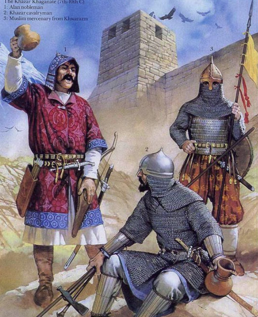
And here are some Khazar warriors:


