Austin, Texas, v1.2.1, pg. 2
If anyone wants to volunteer to help me with the graphics, please let me know!
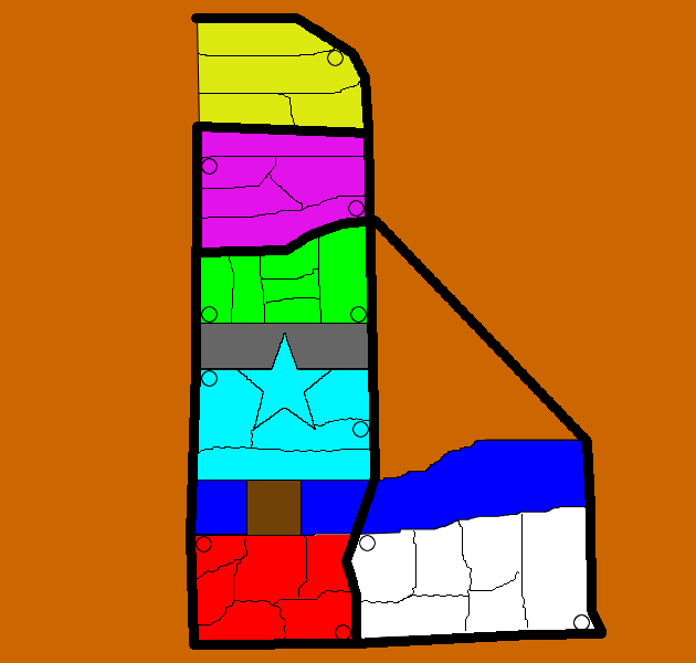
I lived in Austin for 6 years and absolutely love the city. It would be great to have a CC map with some of the classic landmarks around the town. I have made a rough draft that has 22 territories (more than Doodle Earth and only a couple shy of USA West). I would be willing to add more territories if needed, but I thought I'd get feedback first. Version 1.0 is below.
Update to v1.2.1
Alright, another rough drawing, this time in GIMP. All highways (thick, black lines) are impassable. You can only get from one neighborhood to the next by going from a territory with a circle in it to another along the same highways. I'm not sure if all circles should be connected or not. For example, if you want to go from the airport (bottom right whit territory) to Round Rock (yellow), you would have to assault Braker (pink) first. Hope that makes sense. I'll label the territories soon, but until then you can use v1.1 for reference. Labels have been added to the territories.
Territory List
Round Rock
* Georgetown
* Round Rock
* Pflugerville
* Wells Branch
North Austin
* Braker
* Arboretum
* North Lamar
* Far West
* Koenig
Campus
* West Campus
* The Drag
* Union
* Tower
* Library
* Memorial Stadium
Downtown
* Enfield
* Capitol
* "Ridge" Hospital (not sure if I can use the name Breckenridge)
* Sixth Street
* Cesar Chavez
Congress Street Bridge
South Austin
* Zilker Park
* South Congress
* St. Ed's
* South Lamar
* Manchaca
* Ben White
Riverside
* Riverside
* Pleasant Valley
* Lakeshore Park
* Oltorf
* Montopolis
* Austin-Bergstrom International Airport
Previous Versions:
Version 1.2.0
Version 1.1
Version 1.0


