Thanks guys for the warm welcome.
 GRAPHICS
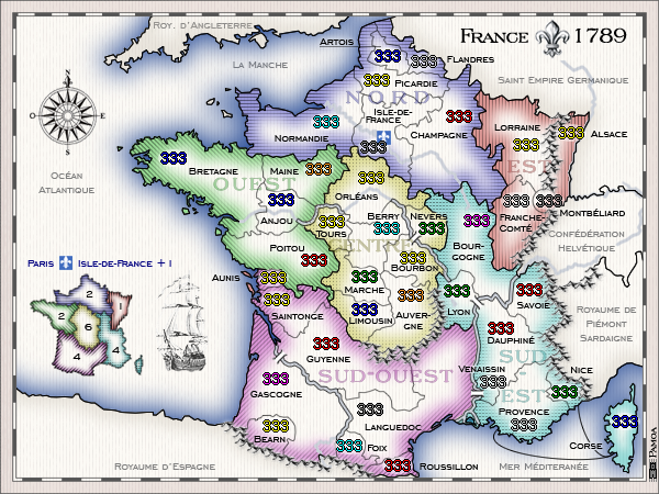
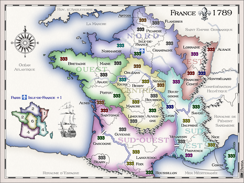
Ruben Cassar:I don't mind the graphics being similar to Ireland however I have one problem with that. It is hard for me to determine where a region stops and another one begins at a first glance. Perhaps you should consider keeping this style but increasing the thickness of the inner stroke so that the colours will be more easily distinguishable between each other.
t-o-m: the colours need a look at though...
AndyDufresne:That is the same problem that cropped up after the Ireland map. I'd advise going with a different style. I enjoy similar looking maps in series, but I think a more unique graphics look can most surely benefit this map, and make you stand out from the crowd.
-> Thanks for pushing me to improve my graphics, i'll work on something for the next version, somthing like a pattern faded in color, i'll see.Ruben Cassar:About the legend...it's very nice, but I have become a fan of mini maps lately, specifically for the reason mentioned above, they are easier to read at a first glance.
-> I don't know, i find it not adapted for what I had in mind for the graphics. i'll stick to my legend for the momentRuben Cassar:I don't particularly like the slanted territory names. Perhaps try to keep a consistent style and keep them all horizontal.
-> i'll fix itRuben Cassar: ...the image in the sea. It's nice but I would like to see Marianne somewhere in this map. Perhaps you could think of somewhere where you can add her? (edit: noticed the 1789 timeline...maybe Marianne came after that date but surely around that time. According to wiki 1792)
-> you noticed well, in fact it is France the day BEFORE revolution and Marianne was an icon of revolution, so it won't happen you will see her on this map even if I understand you did want to see some feminine figure in this very male world  The only symbol i can use is the fleur-de-lys which is the one of the french king and is allready in light grey background of the map
Ruben Cassar: Spelling mistake: It should be written Île-de-France.
-> it is correct, it's the spelling of that time. The ^ accent in the modern version stand for an S in old frencht-o-m: ... those rivers are a bit weird - its hard to see if theyre ment to be there, if theyre immpassables or what (because they dont run along the terit line - that isnt a problem just a bit confusing)
ZeakCytho :Also, the map looks kind of busy now. You might want to consider removing the rivers that are not impassables, or at least decreasing the opacity on them.
-> I think it may need few seconds of adaptation to understand were they are impassable but the double line on each side is quite a clear indication. I also want to keep rivers runing until the sea ( just for geographical coherence) but i'll work on their opacityBalsiefen: ... maybe you should widen the bridges to make them more visible.
-> I'll see how to make them more visibleBalsiefen: Also a very light paperish yellow on the neutral may or may not work.
-> Maybe later, but i'm not sure I want the old map realism go this farKaplowitz: The one thing i dont like is all the dead space. It looks pretty cool, but the map is going to be very tiny when starting the small map. Maybe for the small map at least, you could have it more zoomed in on France?
-> I'll consider it when i'll reach that point of the map developpement and you would surely make some comment at that point if I never reach it.GAMEPLAYRuben Cassar: I noticed those ports in the south. There should be some ports in the north/north west as well? Are you considering using them for anything other than eye candy? (edit: just read that the southern ports are linked)
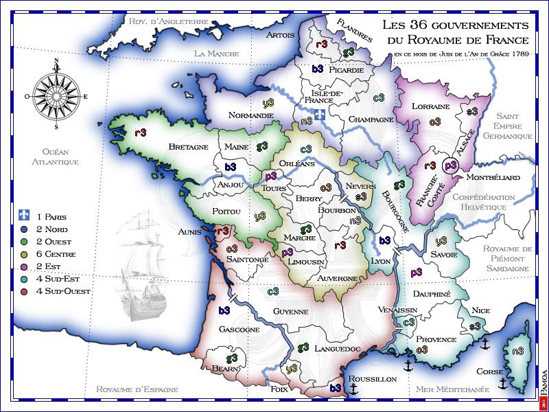
-> I needed to find a way to indicate the links for Corse. But atlantic territories are allready very open so they don't need more connections. I'll make another version of those links and then tell me!Balsiefen: Ouest should be a three and i would possibly also think about knocking nord up to a three would be worthwile as well, I know it has paris as well which basicly makes it a four but for a 6 territ cont with 3 protecting against 6 possible attack directions i think it may be worth it. It may be worth, instead of upping bonuses, to add a couple more impassables.
-> bonuses are just an indication for the moment, I'll wait for more opinion on this pointDiM: for starters the map is too open and each continent has too many borders. look at ouest 4 terits 4 borders. centre 7 terits 4 borders. so basically you either need to split the continents in another way or add some impassable borders otherwise the map will be a massive battle where nobody can hold a continent. (except est)
-> I didn't work hard on the game play for the moment, but i keep in mind your remark about making regions (continents) more closedv02 done!


