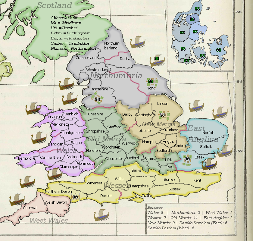
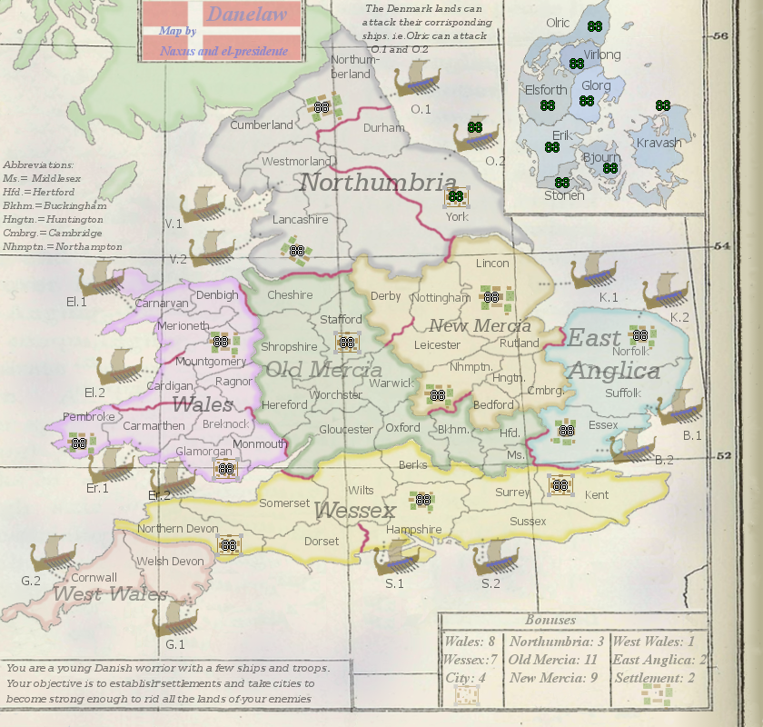
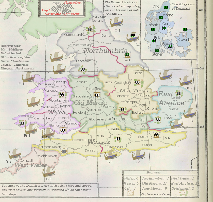
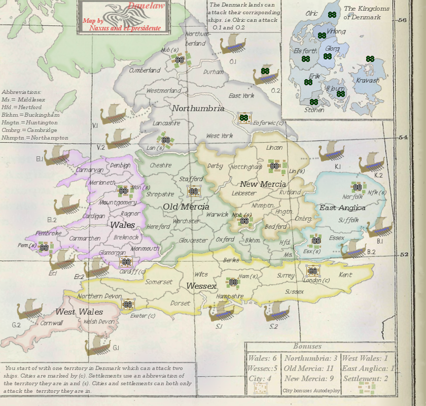
An interesting concept, and a nifty twist on all those Britain maps we keep on seeming to create (dang all this Brits and their love of their country). But I wouldn't be doing my job unless I was giving true feedback, so here we go:
Graphics- The old map of Britain you've superimposed on is nice, but the rest of the map screams "NEW!", including the pure black of the fonts. Fade everything out to look like it's been lying in a textbook for 50+ years, waiting for some intrepid cartographer to dig up and bring to us. A lot of my graphical suggestions follow off of the "olden" idea.
- Change the main text color to approximately the same as the superimposed map. It's a very dark gray, I'd suggest picking the tint off the thicker border along the bottom.
- Older maps, particularly color ones, had a "dot-matrix" look to them, and rarely solid colors (example
here). See if the middle of the territories can begin getting a wash-out to the base map's color.
- If that example map is any indication, adding a slight tinge of blue to note it's the sea would be sweet. Also, add some sea names on both sides of Britannia for extra feel.
- The ships are a good approximation of an actual Viking vessel, but they just seem off to me. No real suggestions on how to improve, just something to tinker with when you get a chance.
- The Abbreviations text needs a box all to itself. You've got the entire top left of the map, since nothing playable if there anyway.
- Where is the title for this map? It's not on the map proper itself, much less who made it. Pride in work my good men, pride in work.
- Consider the deletion of Scotland and the small bit of Ireland, as they have zero relevance to the gameplay of this map and you're pressed for space.
Gameplay- All the bonuses seem inflated as all get-out. Run the continents through a bonus calculator if you possibly could.
- If the red marks are impassables, there's no way for me to know given the map. Note that somewhere. And something a bit cooler than a simple red line would be nice.
- It's Westmoreland in the 9th century, I'm fairly certain. Double-check me though.
- There is zero explanation of the role of Denmark in this version, much less the ships. I cannot intuit attack routes from what's presented because of this. I suppose this is a side-effect of the half-update, but the way they were presented in older versions...get a box.
- What bonuses do the cities and farms give? No clue here. If caused by half-update, consider a box when you add it.
- The bonus box is fairly haphazard. Adding some order, whether it be a three-column setup or something similar would be grand. Take advantage of Layer copy to extend the already-there box for your needs.
- It's spelled Danish Settlers.
I do believe that covers all I have for now, which is a tome in its own regard. Consider this map

.


