Dynamic shapeshifting maps
i've suggested this years ago and got a stern NO for an answer. but since i came back i see a lot of new xml features and a general "can do" attitude towards new map ideas. yeah the foundry is pretty much in a vegetative state but that's another discussion.
anyway, i can't for the life of me find my post from years ago so here's what it's all about.
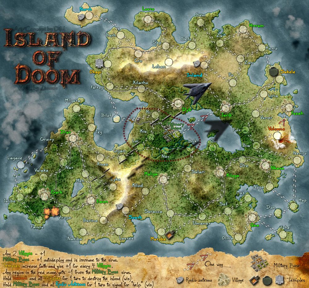
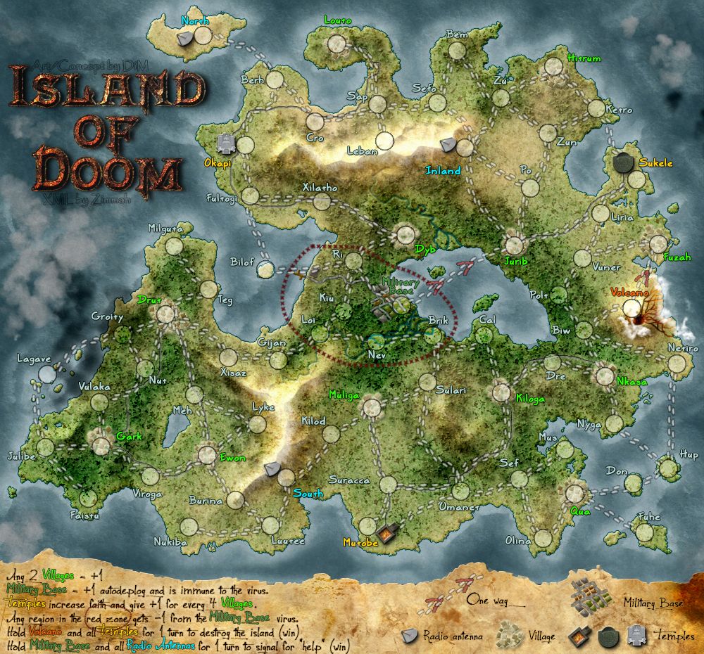
basically we have triggers and conditions in the xml. but that's not reflected in the map image cause we have just 1 image.
so i'd like to make a map in the form of squares. a map that's 800*600 could be split into 48 squares of 100*100px each. now some squares will be fixed and others will be changeable according to what's going on in the game. let's say we have a terit that acts as a trigger that opens the path between 2 other terits allowing you to attack there. this could change from a closed gate to an open one. it would not only be a neat cosmetic feature but it would also provide an immediate visual clue for the player, telling him that path has opened.
or another example. let's say you have a steel factory and an iron mine that form a bonus of +2. but if you own just of them then it's a bonus of -1. this could easily be represented on the map by changing the factory from a nice productive one to an image with an abandoned one, or to one that has little men on strike.
or a well + crop field and when you own both the crop field is a lush green and when you own just one it looks like a barren land.
or a terit that becomes affected by a virus and starts to decay. it could change it's appearance completely showing you at a glance that a terit that was once safe to leave troops in, is now a danger zone that will decay your troops.
yes, this would involve more work for the mapmakers. but it wouldn't be a lot more as only some key areas would need multiple variations. plus it would be completely optional.
i'm completely oblivious when it comes to programming so maybe there's an easier and better solution. but at this point i'm thinking that 100*100px squares would be just what's needed. each square receives a name according to it's coordinates and version (A1-v1, D8-v3, etc) and then in the xml you'd just have to write something like change "change A1-v1 to A1-v2 if continent X is held". or something along these lines.
thoughts? ideas?
anyway, i can't for the life of me find my post from years ago so here's what it's all about.
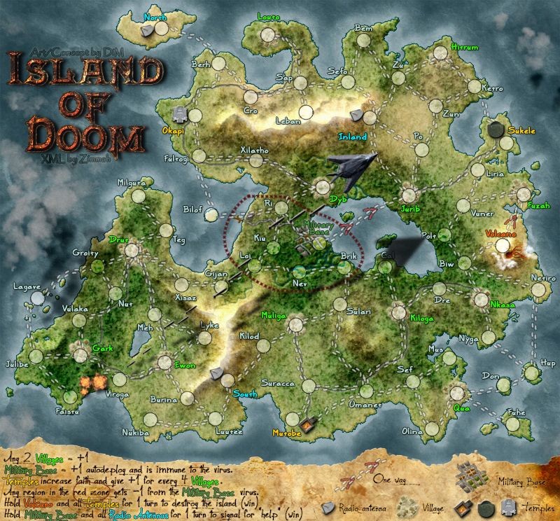
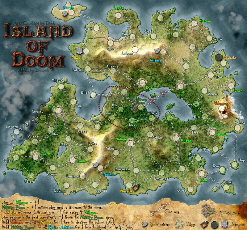
basically we have triggers and conditions in the xml. but that's not reflected in the map image cause we have just 1 image.
so i'd like to make a map in the form of squares. a map that's 800*600 could be split into 48 squares of 100*100px each. now some squares will be fixed and others will be changeable according to what's going on in the game. let's say we have a terit that acts as a trigger that opens the path between 2 other terits allowing you to attack there. this could change from a closed gate to an open one. it would not only be a neat cosmetic feature but it would also provide an immediate visual clue for the player, telling him that path has opened.
or another example. let's say you have a steel factory and an iron mine that form a bonus of +2. but if you own just of them then it's a bonus of -1. this could easily be represented on the map by changing the factory from a nice productive one to an image with an abandoned one, or to one that has little men on strike.
or a well + crop field and when you own both the crop field is a lush green and when you own just one it looks like a barren land.
or a terit that becomes affected by a virus and starts to decay. it could change it's appearance completely showing you at a glance that a terit that was once safe to leave troops in, is now a danger zone that will decay your troops.
yes, this would involve more work for the mapmakers. but it wouldn't be a lot more as only some key areas would need multiple variations. plus it would be completely optional.
i'm completely oblivious when it comes to programming so maybe there's an easier and better solution. but at this point i'm thinking that 100*100px squares would be just what's needed. each square receives a name according to it's coordinates and version (A1-v1, D8-v3, etc) and then in the xml you'd just have to write something like change "change A1-v1 to A1-v2 if continent X is held". or something along these lines.
thoughts? ideas?